The Daily Render

by

A Digital Scrapbook for the Past, Present, and Future.

| HOME | GEOSPATIAL ART | COLONIST | FOUND MAPS | FRACTALS | PHOTOGRAPHY | ANTIQUE | DESIGN | VIDEO | BLOGROLL | PRICE LIST | RANDOM | CONTACT |


|| 6/12/2005 || 6:15 pm ||
Jefferson Mandala

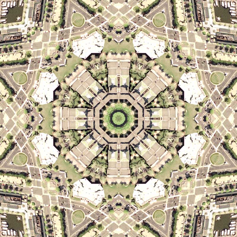
This rendering marks two significant pinnacles in my geographic artistry.

The biggest step is of making a complete mandala. Before my mandalas were only reflected 4 ways (north, south, east, west) , and now I am achieving reflections of over 8 ways (north-north east, east-north east, etc), which make the final products so much more intricate and in my opinion, far superior to my older maps.

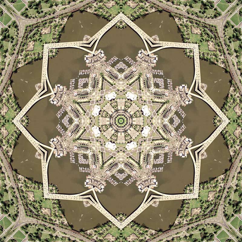
Secondly, the source imagery used for this image was what I’d like to call first derivative geospatial imagery. I have coined term to signify that the source imagery is the first derivation of a previously rendered image. In the image above, I used the rendered imagery from the center of the Mall Quilt as my source imagery for this rendering.

With source imagery’s self-similar design it’s closer to the definition of a fractal. You can zoom into a fractal to infinite, and what I think I’ve created is in effect a geographic fractal where I can take derivatives of renderings and reproject them into infinity. Each derivation will be more reflected and abstract, but I will not lose the spatial resolution so long as the final rendered dimensions are not larger than the source imagery dimensions multiplied by the number of times the source imagery is completely shown.

For example, the source imagery used to make the image above was 6000X6000 pixels, however the image above was rendered at 12000X12000 pixels. I am able to reproject the imagery larger because the actual source imagery is used multiple times within the image and in essence is doubled by the way the source imagery tessellates. Notice how you see a mirror of the Jefferson Memorial (aka 2x for every reflection), the mirroring process allows for the geographic tessellation to not lose spatial resolution when the image is finally rendered. Theoretically, I could cut out the center of this rendering, and use for my next rendering, and it would technically be considered second derivative geospatial imagery…and I might just do that :)

If this is too confusing, I’m sorry. I too am still trying to get my mind around this concept. Regardless, expect some very beautiful renderings in the near future!

View the map’s close-up details using the interactive Flash application called Zoomify

View the Google Map of the Jefferson Memorial in Washington, DC


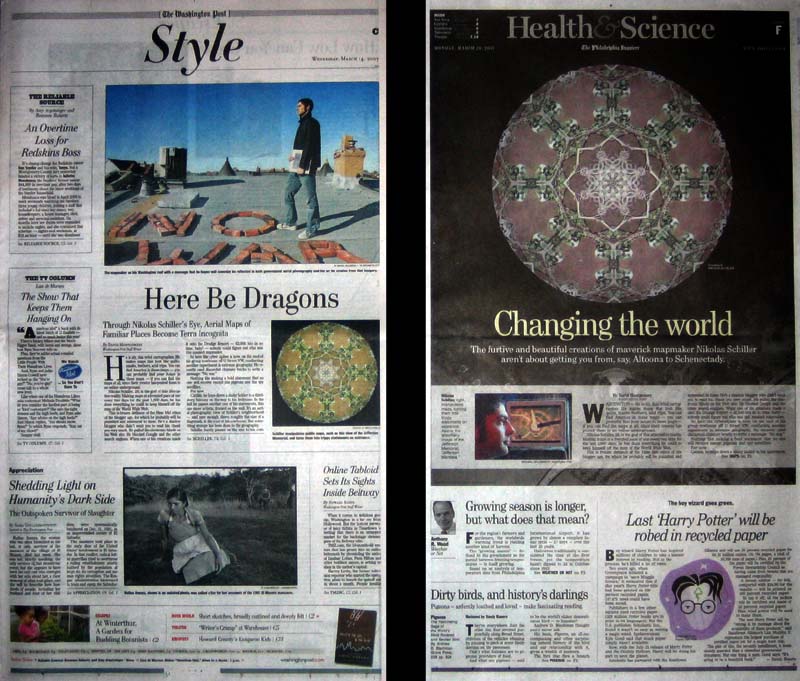
This map was printed over a million times in newspapers around the world.

View rendering details:

: zoom to center :
The once fully visible USDA building, has now been merged…

Comments Off |


Post Title: Jefferson Mandala
Posted in: DC, Fractal, General, Jefferson Memorial, Mall, Mandala, Renderings, Ward2


No comments yet.

+ RSS feed for comments on this post.

Sorry, the comment form is closed at this time.


^^^^^^^ the advertisement above is not an endorsement ^^^^^^^

Twitter Updates From @NikolasSchiller

+Follow me on Twitter


The Daily Render By

A Digital Scrapbook for the Past, Present, and Future.

©2004-2009 Nikolas R. Schiller - Colonist of the District of Columbia - Privacy Policy - Fair Use - RSS - Contact


Custom Search


^^^^^^^ the advertisement above is not an endorsement ^^^^^^^


Photo by Charlie McCormick
Nikolas Schiller is a 29-year-old cartographer, consultant, digital artist, researcher, photographer, civil rights activist, and blogger living in America's last continental colony, Washington, DC. If you have any questions or comments, please contact:


+ Facebook
+ Twitter
+ YouTube
+ MySpace
+ Google
+ Vimeo


::SUBSCRIBE::

I am taking a brief break from daily blog postings. Please subscribe to be notified when I resume!


::MAPS & DESIGNS BY YEAR::

+ 95 in 2008
+ 305 in 2007
+ 213 in 2006
+ 122 in 2005
+ 106 in 2004

::SUPPORT::

pay with paypal
Visit My On-Line Store


Release date: September 1st, 2009
View Original Map


"Supreme Illusion" by Thievery Corporation (ESL110) is still available
View Front | View Back


View Original Map

:: ADS ::

::IN THE NEWS::

Washington Post - Artomatic '09: Survival Tips From an Expert

The Art of Map Fest by Teresa Méndez, Christian Science Monitor

Caught Google censoring downtown Washington, DC

Front page of WashingtonPost.com 3-14-07

MORE

::RECENT EXHIBITIONS::

Photocartographies: Tattered Fragments of the Map
Artomatic Entries
North, South, East, Westminster

MORE

::THE QUILT PROJECTION::

Square
Square

Diamond
diamond

Hexagon
hexagon

Octagon
octagon

Dodecagon
Dodecagon

Beyond
beyond

::OTHER PROJECTIONS::

The Lenz Project
Lenz

Mandala Project
Mandala

The Star Series


Abstract Series
abstract

Memory Series
Memory

Mother Earth Series
Mother Earth

Misc Renderings
Misc

::SOME FAVORITE MAPS::

- The Los Angeles Interchanges Series
- The Lost Series
- Terra Fermi
- Antique Map Mashups
- Google StreetView I.E.D.
- LOLmaps
- Washington, DC Congressional Representation Google Map
- The Inaugural Map
- The Shanghai Map
- Ball of Destruction
- The Lenz Project - Maps at the Library of Congress
- Winner of the Everywhere Man Award

:: ADS ::

::MONTHLY ARCHIVES::

::LOCATIONS & CATEGORIES::

:: ADS ::

::LAST 51 POSTS::

::OTHER::

Fair Use


20 queries. 1.152 seconds.
Powered by WordPress


:: LAST VISITORS ::