: rendered at 18,000 X 12,000 :

View the Google Map of downtown Pittsburgh, Pennsylvania

+ MORE
| FRONT PAGE |
GEOSPATIAL ART |
DC HISTORY / TIMELINE |
NEWS |
COLONIST |
FOUND MAPS |
FRACTALS |
|
PHOTOGRAPHY |
ANTIQUE |
DESIGN |
VIDEO |
|
CONTACT |
Pittsburgh Quilt #3
|| 4/13/2006 || 8:50 am || Comments Off on Pittsburgh Quilt #3 || ||
Pittsburgh Quilt #2
|| 4/12/2006 || 8:45 am || Comments Off on Pittsburgh Quilt #2 || ||
Pittsburgh Quilt
|| 4/11/2006 || 8:36 am || Comments Off on Pittsburgh Quilt || ||
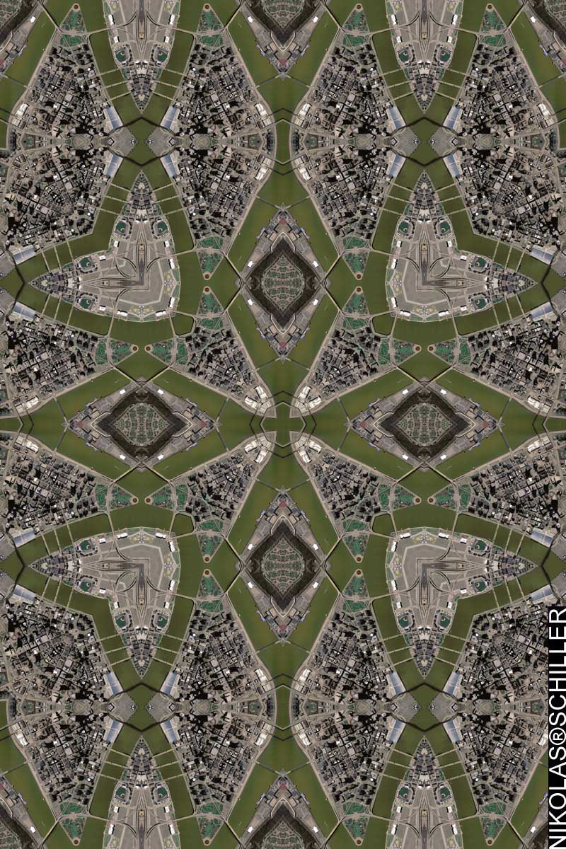
So I made 5 different maps of Pittsburgh and when I was post-processing them I discovered that 2 of the maps were not perfect. I found that a seam was off by a few pixels and I find this to be unacceptable, so I deleted the maps. This isn’t the first time this has happened, but it’s the first time it’s happened when I was making a series.
According to the meta-data, the aerial photography was taken on April 5th, 2005, processed in May of 2005, and released in October of 2005. The source spatial resolution is .3 meters per pixel, which gives a lot of detail.
View the Google Map of downtown Pittsburgh, Pennsylvania
+ MORE
©2004-2026 Nikolas R. Schiller - Former Colonist of the District of Columbia - Privacy Policy - Fair Use - RSS - Contact
::LAST 51 POSTS::
50 queries. 3.062 seconds.
Powered by WordPress


::THE QUILT PROJECTION::
Square |
Diamond |
Hexagon |
Octagon |
Dodecagon |
Beyond |
::OTHER PROJECTIONS::
The Lenz Project |
Mandala Project |
The Star Series |
Abstract Series |
Memory Series
|
Mother Earth Series
|
|
Misc Renderings
 |
::POPULAR MAPS::
- The Los Angeles Interchanges Series::MONTHLY ARCHIVES::
::LOCATIONS & CATEGORIES::
