The Daily Render

by

A Digital Scrapbook for the Past, Present, and Future

| FRONT PAGE | GEOSPATIAL ART | DC HISTORY / TIMELINE | NEWS | COLONIST | FOUND MAPS | FRACTALS |
| PHOTOGRAPHY | ANTIQUE | DESIGN | VIDEO | | CONTACT |

[Commissioned Map] Sandy Spring Friends School – Tessellation Three
|| 7/29/2009 || 10:23 pm || 5 Comments Rendered || ||

: rendered at 900 X 600 :
Sandy Spring Friends School Quilt by Nikolas R. Schiller

These two maps feature identical tessellations of the area around the Sandy Spring Friends School in Maryland, but shown at two different spatial scales and rotate 22.5 degrees.


: rendered at 900 X 600 :
Sandy Spring Friends School Quilt by Nikolas R. Schiller

Click here to read more about the commissioned map & rendering series here.
Click here to view the Google Map of Sandy Spring Friends School in Maryland.


Related Entries:
[Commissioned Map] Sandy Spring Friends School – Tessellation One
[Commissioned Map] Sandy Spring Friends School – Tessellation Two
[Commissioned Map] Sandy Spring Friends School – Tessellation Three
[Commissioned Map] Sandy Spring Friends School – Tessellation Four
[Commissioned Map] Sandy Spring Friends School – Tessellation Five
[Commissioned Map] Sandy Spring Friends School Quilt
Photo of the Sandy Spring Friends School Quilt Printed on Polyester Fabric


[Commissioned Map] Sandy Spring Friends School – Tessellation Two
|| 7/25/2009 || 9:39 pm || 6 Comments Rendered || ||

: rendered at 900 X 600 :
Sandy Spring Friends School Quilt by Nikolas R. Schiller

This map features a different tessellation of the area around the Sandy Spring Friends School in Maryland.


Click here to read more about the commissioned map & rendering series here
Click here to view the Google Map of Sandy Spring Friends School in Maryland.


Related Entries:
[Commissioned Map] Sandy Spring Friends School – Tessellation One
[Commissioned Map] Sandy Spring Friends School – Tessellation Two
[Commissioned Map] Sandy Spring Friends School – Tessellation Three
[Commissioned Map] Sandy Spring Friends School – Tessellation Four
[Commissioned Map] Sandy Spring Friends School – Tessellation Five
[Commissioned Map] Sandy Spring Friends School Quilt
Photo of the Sandy Spring Friends School Quilt Printed on Polyester Fabric


[Commissioned Map] Sandy Spring Friends School – Tessellation One
|| 7/21/2009 || 8:50 pm || 6 Comments Rendered || ||

: rendered at 900 X 600 :
Sandy Spring Friends School Quilt by Nikolas R. Schiller

I was recently commissioned by a person who wishes to have me a make a map of Sandy Spring Friends School as a gift for their friend. The person asked explicitly for a map on fabric that uses the Octagon Quilt Projection. This made the process somewhat easier for me because all I needed to do was create different tessellations of the aerial photography around the school. Often the client does not know the map design they desire most, so I have to spend extra time rendering different designs based off of one or two tessellations. This time around I was able to focus on making numerous tessellations for the client to choose from.


Click here to view the Google Map of Sandy Spring Friends School in Maryland.


Below is the same tessellation, but shown at a different scale:

: rendered at 900 X 600 :
Sandy Spring Friends School Quilt by Nikolas R. Schiller

Related Entries:
[Commissioned Map] Sandy Spring Friends School – Tessellation One
[Commissioned Map] Sandy Spring Friends School – Tessellation Two
[Commissioned Map] Sandy Spring Friends School – Tessellation Three
[Commissioned Map] Sandy Spring Friends School – Tessellation Four
[Commissioned Map] Sandy Spring Friends School – Tessellation Five
[Commissioned Map] Sandy Spring Friends School Quilt
Photo of the Sandy Spring Friends School Quilt Printed on Polyester Fabric


Before & After Aerial Photographs of Ground Zero in Nagasaki, Japan
|| 7/19/2009 || 8:15 pm || + Render A Comment || ||

I was looking at the Wikipedia entry on Aerial Bombing of Cities and came across the World War Two aerial photograph above. It shows the absolute destruction of the Nagasaki, Japan after the atomic bomb known as “Fat Man” was dropped from the sky and detonated in the heart of the city. Below is a screen grab from Google Maps showing a contemporary view of ground zero:

…from life to death to life… Its rather amazing how much development has taken place since the war ended over 60 years ago. I just hope this type of bombing never happens again.


Dear Yahoo! & Navteq, it’s not the National Msm of the American Indian!
|| 7/13/2009 || 3:49 pm || 1 Comment Rendered || ||

Back in March of 2008 I discovered that Google Maps was incorrectly displaying the official title of the National Museum of the American Indian on their maps. They had truncated the word museum to MSM. A friend of mine who works at Navteq, the supplier of the data, confirmed that the length of the title was too long, so they shaved off a few characters by truncating the word museum to msm. This lexical error was eventually corrected on Google Maps….

However, last night I had someone in India do a Yahoo! search for National Msm of the American Indian and ended up visiting my page. Upon closer inspection, I discovered that Yahoo! Maps was also doing the same type of truncation with Navteq’s data. I think NavTeq should to change it’s dataset so all the museums names are spelled correctly.

Note: the links in the images in this entry go to the Hirshhorn Museum & Sculpture Garden because it was the closest result for my query “National Msm of the American Indian”


Note to the cartographers at the New York Times: the Red Line goes into Maryland
|| 7/11/2009 || 7:00 pm || + Render A Comment || ||

I know this a bit late, but I was looking over the coverage of the DC Metro train collision last month on the websites of the Washington Post (below) and the New York Times (above) and noticed one glaring error in the New York Times map. The Red Line does not start and end at the borders of the District of Columbia, rather it extends far into the state of Maryland. Maybe the New York Times can issue a cartographic correction?

I guess you could say this is a good example of when the local newspaper gets it right…


Related Found Maps:

+ MORE


[FOUND MAP] Isola d’Elba aka the Island of Elba
|| 7/10/2009 || 5:49 pm || + Render A Comment || ||

Click the map above to view the larger version

The other night I was over at my friend’s house in the Adams Morgan neighborhood of Washington, DC for her going away party and saw this map hanging on the wall.

Isola d’Elba aka the Island of Elba is an island in Tuscany, Italy, 20 kilometres (12 mi) from the coastal town of Piombino. It is the largest island of the Tuscan Archipelago, located between the Tyrrhenian Sea and Ligurian Sea, and the third largest island in Italy after Sicily and Sardinia. This map shows the island with various cities, embellishments of fruit, flowers, & fish, important mountains on the island, and at the top of the map there is an iconic graphic of Napoleon Bonaparte riding a horse.

I first read about the Island of Elba when I was learning about French emperor Napoleon I in high school. Following the Treaty of Fontainebleau, Napoleon was exiled to Elba after his forced abdication in 1814 and arrived at Portoferraio (near the steamboat on the map) on May 3, 1814. He stayed on Elba for only 300 days and returned to France only to be exiled again to the far more distant Island of Saint Helena.

Below is a Library of Congress copy of a British engraving depicting Napoleon’s banishment to Elba in 1814:

It’s titled “The journey of a modern hero, to the island of Elba” and says at the bottom:

Farewell my brave soldiers, my eagles adieu;
Stung with my ambition, o’er the world ye flew:
But deeds of disaster so sad to rehearse
I have lived–fatal truth for to know the reverse.
From Moscow to Lipsic; the case it is clear
I was sent back to France with a flea in my ear.

A lesson to mortals regarding my fall:
He grasps at a shadow, by grasping at all.
My course it is finish’d my race it is run,
My career it is ended just where it begun.
The Empire of France no more it is mine.
Because I can’t keep it I freely resign.

Coming from the butt of the donkey is the text: “The greatest events in human life is turn’d to a puff.” Coming from the broken sword is the text: “A throne is only made of wood and cover’d with velvet.” Written on the saddle are two phrases: “The budget of Mathematical books for my study at ELBA.” & “Materials for the history of my life and exploits.”


Related Found Maps:

+ MORE


[Found Map] Topographic window sign at Current Lounge & Sushi Restaurant
|| 7/9/2009 || 6:22 pm || 1 Comment Rendered || ||

The other day I was walking by Current Lounge & Sushi Restaurant in Washington, DC and noticed that they were using contour lines as a visual design element on their window signs. On topographic maps, contour lines represent the vertical elevation change. The closer the contour lines are together on the map, the steeper the incline. Conversely, the more distance between contour lines, the flatter the topography.

In theory, the contour lines on the Current Lounge & Sushi Restaurant are supposed to represent the height of the three main area codes in the DC area- 202 (Washington, DC), 301 (Southern Maryland), and 703 (Northern Virginia), however, after looking over these “maps,” I don’t think the elevations are correctly shown. Check out the rest of the photos below:

+ MORE


The Craig Retroazimuthal Projection aka the Mecca Projection
|| 4/21/2009 || 11:45 am || Comments Off on The Craig Retroazimuthal Projection aka the Mecca Projection || ||

The Craig retroazimuthal map projection was created by James Ireland Craig in 1909. It is a cylindrical projection preserving the direction from any place to another predetermined place, while avoiding some of the bizarre distortion of the Hammer retroazimuthal projection. It is sometimes known as the Mecca projection because Craig, who had worked in Egypt as a cartographer, created it to help Muslims find their Qibla. Check out the mathematical calculation used to create the map on Wikipedia.

I think it would be neat to use this cartographic projection technique to create a map that uses Washington, DC as the center.


Related Mecca Entries:

+ MORE


|| Upcoming Exhibition || Photocartographies: Tattered Fragments of the Map
|| 4/14/2009 || 6:14 pm || + Render A Comment || ||

Photocartographies: Tattered Fragments of the Map is a curatorial project materializing in multiple forms: an exhibition, a publication and a series of public programs.

Photography and cartography are entwined in similar processes of subject orientation that structure our experience of social, environmental and virtual landscapes. A map is not a representation so much as a system of propositions. This project reveals mapping itself as a generative process of knowledge creation, a liberatory method for re-imagining and re-imaging our world, its built and natural environments, and the relationship between space and place.

Maps are tied to a history of authority, scientific rationality and practical application, masking the underlying subjectivity and biases of their creation. Satellite-based navigation, the disciplines of geography and, more recently, urban planning, have popularized and proliferated map imagery while helping to cement an aura of unassailable cartographic objectivity. Maps have become ubiquitous tools in our daily lives, and are understandably identified in accordance with a few simple assumptions: they are graphic representations of spatial relations and their creators are technicians bound to graphic systems that reflect a physical reality. However, the true nature of maps is one of distortion, beginning with their projections of three-dimensional surfaces onto two-dimensional frames, and compounded by territorialization, a habit of identifying, naming and claiming. Maps are image-objects in which different conceptions and configurations of time and space are created, not just charted.

In 1858 Gaspard Felix Tournachon executed the first aerial photographs from a hot air balloon tethered above the Paris skyline. In turn, Baron Haussmann employed this omniscient view to redesign the city, combating its perceived disorder. Over the last 150 years, people have used zeppelins, airplanes, and satellites to photographically capture and archive every piece of our globe with increasing accuracy and frequency.

More recently, public access to maps, as well as the access to their means of production, have been greatly enabled by digital technologies—most notably tools such as Google Earth and freely accessible archives like those offered by the USGS. Borges’ story of mapping the entire Kingdom with exactitude may seem improbably complete. And yet, maps can never escape being part of the world their creators try to represent. Like the photographic image, “The map does not reproduce an unconscious closed in upon itself; it constructs the unconscious” by coding power, politics, and aesthetics. All maps are still projections, and all territories are maps.

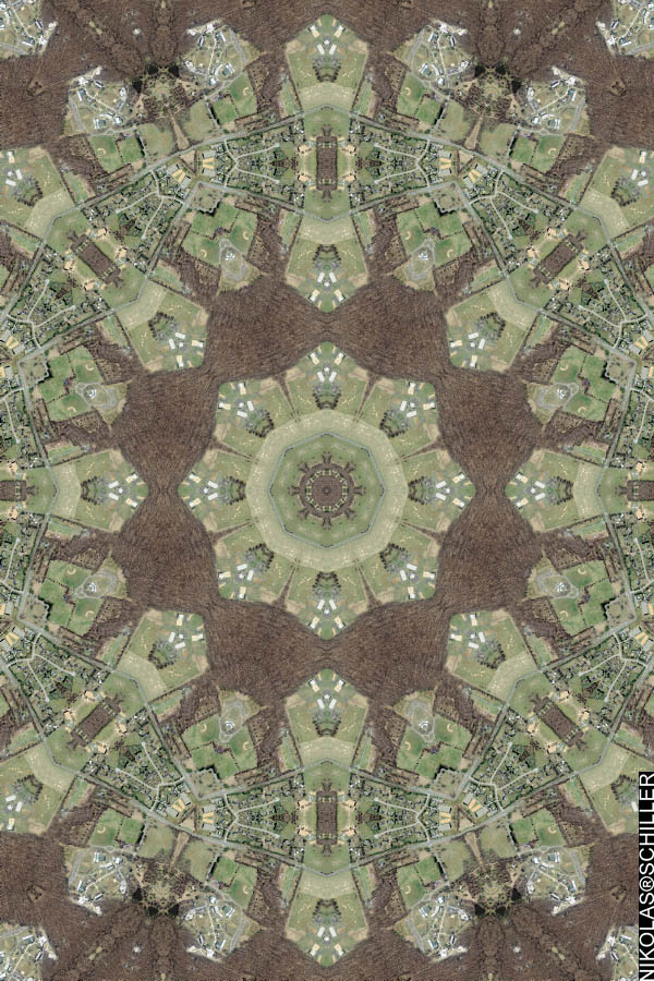
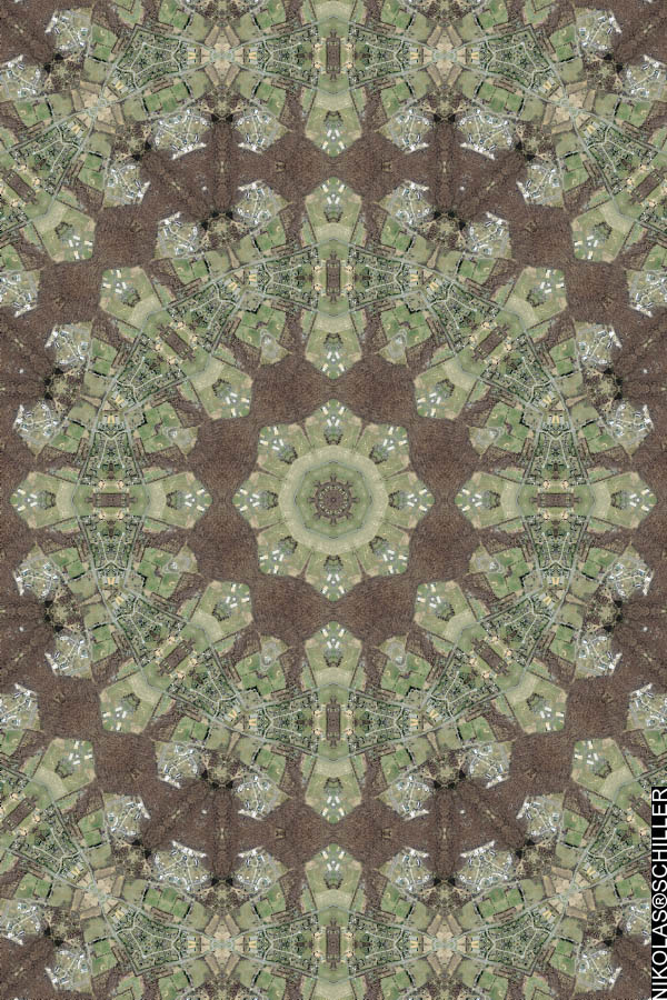
Mapping and photography are conceptual frameworks, rather than methods, that inform this project. The exhibition features artwork from Anthony Auerbach, Katherine Bash, Charles Benton, Noah Beil, Mike Hernandez, David Horvitz, David Maisel, Adam Ryder, Oraib Toukan, Angie Waller, and Nikolas Schiller.

Exhibition Opening – May 16, 7:00-10:00
Exhibition @ Gallery 727
727 South Spring Street, downtown Los Angeles
www.TatteredFragments.info


If you are in the Los Angeles area please check out the exhibition! It will be up until July 3rd, 2009.


Click here to view photos from the gallery opening


The Daily Render By
A Digital Scrapbook for the Past, Present, and Future.

©2004-2023 Nikolas R. Schiller - Colonist of the District of Columbia - Privacy Policy - Fair Use - RSS - Contact


::LAST 51 POSTS::

Fair Use


54 queries. 0.734 seconds.
Powered by WordPress

Photo by Charlie McCormick
Nikolas Schiller is a second-class American citizen living in America's last colony, Washington, DC. This blog is my on-line repository of what I have created or found on-line since May of 2004. If you have any questions or comments, please contact:

If you would like to use content found here, please consult my Fair Use page.

::THE QUILT PROJECTION::

Square
Square

Diamond
diamond

Hexagon
hexagon

Octagon
octagon

Dodecagon
Dodecagon

Beyond
beyond

::OTHER PROJECTIONS::

The Lenz Project
Lenz

Mandala Project
Mandala

The Star Series


Abstract Series
abstract

Memory Series
Memory

Mother Earth Series
Mother Earth

Misc Renderings
Misc

::POPULAR MAPS::

- The Los Angeles Interchanges Series
- The Lost Series
- Terra Fermi
- Antique Map Mashups
- Google StreetView I.E.D.
- LOLmaps
- The Inaugural Map
- The Shanghai Map
- Ball of Destruction
- The Lenz Project - Maps at the Library of Congress
- Winner of the Everywhere Man Award

::MONTHLY ARCHIVES::


::LOCATIONS & CATEGORIES::

  • 2004 Elections (2)
  • 2008 Elections (35)
  • 2014 Elections (4)
  • 2016 Elections (2)
  • ACLU (3)
  • Activism (287)
  • Adbusters (13)
  • Advertisements (33)
  • aerial photography (19)
  • Analysis (31)
  • Animals (30)
  • animated gif (7)
  • Animation (25)
  • Antique (104)
  • Apple (1)
  • Arabic (17)
  • Architectural Archeology (9)
  • Artomatic (25)
  • Astronomy (15)
  • Astrophotography (9)
  • Audio (2)
  • Awards (3)
  • Backpacking (2)
  • banner graphics (5)
  • Beat Google to the Map (56)
  • bicycle (23)
  • Birds-Eye View (5)
  • Blaeu (10)
  • Book Covers (7)
  • Bridge (10)
  • Building (15)
  • calendar (28)
  • calligraphy (6)
  • Capital (61)
  • Cars (18)
  • Cartography (74)
  • Cartoon (9)
  • Celestial (31)
  • Censorship (32)
  • Chinese (7)
  • Chronicling America (34)
  • Classroom (5)
  • Clothing (12)
  • Commentary (76)
  • Commissioned (27)
  • Credit Cards (3)
  • Crime (12)
  • Cyrillic Alphabet (1)
  • DAILY LINKS (30)
  • Dance (2)
  • DC History (93)
  • Design (102)
  • Digital Scrap (5)
  • Election (11)
  • ESA (3)
  • Facebook (19)
  • Fantasy (3)
  • Fashion (23)
  • Fast Food (2)
  • FBI (7)
  • Flag (15)
  • flickr (4)
  • Found Map (56)
  • French (9)
  • Gallery (54)
  • Gardening (25)
  • General (256)
  • George Bush (12)
  • GIS (69)
  • GMO Labeling (4)
  • Google (31)
  • Google AdSense (4)
  • Google AdWords (3)
  • Google Earth (28)
  • Google Maps (47)
  • Google Reader (4)
  • Google Streetview (8)
  • GPS (7)
  • Graffiti (5)
  • Greek (4)
  • Green (72)
  • Green Party (18)
  • Healthcare (15)
  • Highway (35)
  • Hiking (2)
  • Hipster (2)
  • history (151)
  • Holidays (10)
  • House Party (2)
  • Hubble Telescope (2)
  • Humor (88)
  • In The News (88)
  • Insects (2)
  • Interactive (74)
  • Interiors (4)
  • IP Trace (28)
  • Latin (22)
  • Law (15)
  • Lecture (11)
  • Legislation (19)
  • Library (21)
  • Library of Congress (66)
  • Location (1,018)
  • LOLMaps (3)
  • Mass Transit (6)
  • Memorandum (2)
  • meta-data (32)
  • Mobile Phone Applications (1)
  • Movie (3)
  • MrSID (4)
  • MSN (5)
  • Museum (5)
  • Music (48)
  • MySpace (6)
  • NASA (10)
  • National Archives (3)
  • News (182)
  • Obituary (2)
  • Oil (4)
  • Ornithology (4)
  • orthophotography (4)
  • OSCE (16)
  • Photography (134)
  • Poetry (18)
  • Portuguese (1)
  • postmodern (8)
  • QR code (9)
  • QTVR (4)
  • Radio (3)
  • Renderings (675)
  • RSS (3)
  • Seasons (12)
  • Sold (40)
  • Spanish (7)
  • Speech (5)
  • Sports (1)
  • Stadium (40)
  • statehood (94)
  • Statistics (2)
  • Stellarium (4)
  • Stereogram (1)
  • Street (21)
  • Street Art (10)
  • Submissions (5)
  • Tattoo (2)
  • Testimony (2)
  • time-lapse (19)
  • Torture (3)
  • Transportation (6)
  • TV (23)
  • Twitter (5)
  • University (41)
  • Update (24)
  • Vegetarianism (2)
  • Video (49)
  • Vimeo (18)
  • visualization (36)
  • Washington Critic (2)
  • Weather (19)
  • Web Crawler (9)
  • Wikipedia (14)
  • Wordpress (4)
  • Wordpress Upgrade (2)
  • World Wind (3)
  • Yahoo (6)
  • YouTube (113)
  • Zodiac (23)


  • thank you,
    come again!