Using map #10 from 1880 Statistical Map of the City of Washington, I was able to make this unique, interactive, antique map mashup.

+ MORE
| FRONT PAGE |
GEOSPATIAL ART |
DC HISTORY / TIMELINE |
NEWS |
COLONIST |
FOUND MAPS |
FRACTALS |
|
PHOTOGRAPHY |
ANTIQUE |
DESIGN |
VIDEO |
|
CONTACT |
1880 Street Railway Map of the City of Washington
|| 9/14/2007 || 4:28 pm || Comments Off on 1880 Street Railway Map of the City of Washington || ||
Using map #10 from 1880 Statistical Map of the City of Washington, I was able to make this unique, interactive, antique map mashup.
+ MORE
MyGoogleMaps : Google’s Censorship Perimeter
|| 7/29/2007 || 4:42 pm || Comments Off on MyGoogleMaps : Google’s Censorship Perimeter || ||
&ie
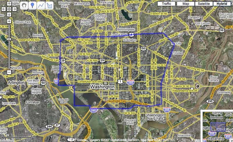
I previously made a few static maps of the area but today I decided to make a MyGoogleMap so that others may interactively explore the area of Google’s censorship. I tried my best to be within 50ft of the line throughout the roughly 12 mile perimeter. As I stated yesterday, the area matches up with Google’s 3D buildings and I still feel that Google should update the entire downtown area with the most recent imagery.
3D Buildings at the expense of newer imagery?
|| 7/28/2007 || 3:59 pm || Comments Off on 3D Buildings at the expense of newer imagery? || ||
After conducting some more analysis concerning Google’s censorship of Washington, DC, I discovered a possible reason as to why the older imagery is being used….. 3D Buildings
+ MORE
Google’s View of D.C. Melds New and Sharp, Old and Fuzzy – Washington Post
|| 7/22/2007 || 4:39 pm || Comments Off on Google’s View of D.C. Melds New and Sharp, Old and Fuzzy – Washington Post || ||
Today my analysis concerning Google’s censorship of downtown Washington, DC made it into a story on the front page of the Metro section of the Washington Post.
Here are two snippets from the article by Jenna Johnson titled, “Google’s View of D.C. Melds New and Sharp, Old and Fuzzy”
The older images frustrate cartographer Nikolas Schiller, 26, who takes an artistic approach to mapmaking and is working on an atlas. Schiller, who lives in the U Street area, said that too much of the District is represented using the older photos, diminishing the amount of information — and thrill — that aerial photos can provide.
“Maps are about power,” he said. “Maps decide what gets developed, who lives where, how people get around.”
Schiller said he thinks Google should just use the 2002 map for the small spots the government has censored rather than the whole downtown area.
And he said he’s puzzled that any level of blurriness is needed by anyone — even the government — especially because he recently took a detailed tour of a nuclear reactor south of Detroit via Google Earth.
“Where is the concept of national security in this?” he asked.
By random chance, tomorrow’s map is the nuclear reactor mentioned in the article.
+ MORE
A new change in Washington, DC’s imagery on Google’s servers
|| 7/10/2007 || 9:42 am || 2 Comments Rendered || ||
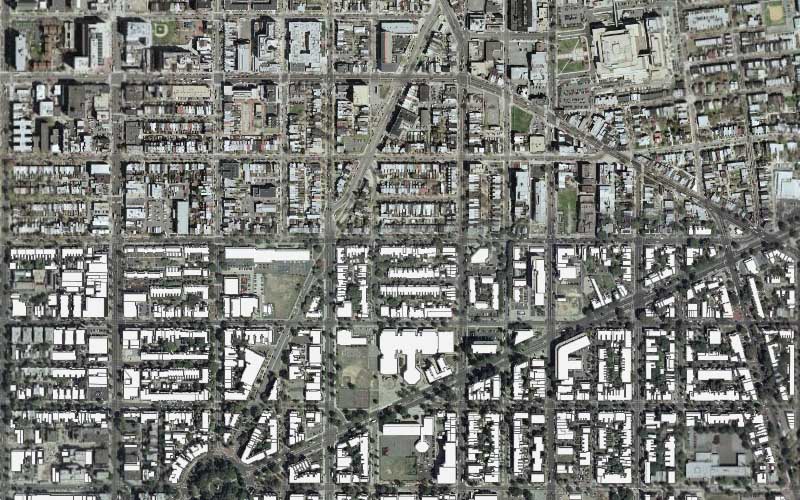
For the last 3 years I have followed how the aerial & satellite imagery of Washington, DC has been released, redacted, and remixed. This entry marks another important observation and a new discovery in Google Maps.

Last week I discovered the extent to which Google has updated their servers with the 2005 USGS aerial photography. My findings suggest that Google has censored much of downtown Washington, DC by not using a substanial amount of newer imagery.
+ MORE
Google StreetView I.E.D. – Blowing Up The Spot
|| 6/11/2007 || 12:40 pm || Comments Off on Google StreetView I.E.D. – Blowing Up The Spot || ||

So the other day I mentioned I was working on a mash-up for Google’s new Street View feature.
The result is the first google bomb for Street View— an improvised explosive device, with a message called Street View I.E.D..
Check it out: www.StreetViewIED.com
Tune up the volume!
new project with Google’s Street View
|| 6/6/2007 || 6:24 am || Comments Off on new project with Google’s Street View || ||
Last week Google released “Street View” for Google Maps. It’s based on georeferenced panoramic photographs within the Google Maps interface. Read more about how it works here. Right now I am working on mashing it up. I think I’ve made a pretty good prototype thus far.
Fun with MyGoogleMaps…
|| 4/5/2007 || 9:51 pm || Comments Off on Fun with MyGoogleMaps… || ||

Yesterday I noticed that Google had added a new feature to Google Maps which allows users to create their own mash-ups. After already learning the basics of the API to create a couple political mash-ups and a couple geospatial art mash-ups, I wasn’t too overtly excited at the prospect of what took me hours of learning now being released so that anyone can make them. But as with all innovations, I’ve learned to have fun with it.
Tonight I made my first two mash-ups using their new interface and as usual I decided to get slightly creative with it. Above is a reference to the fact that DC residents are denied representation in Congress and after the fold is a map that features the number 51, as in D.C. being the 51st state.
+ MORE
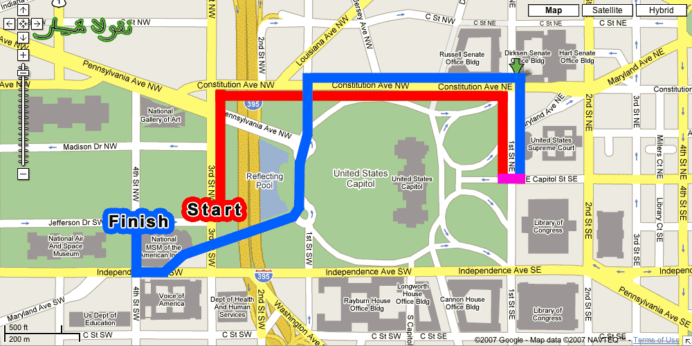
Worst march route ever…
|| 1/27/2007 || 2:00 am || Comments Off on Worst march route ever… || ||
©2004-2023 Nikolas R. Schiller - Colonist of the District of Columbia - Privacy Policy - Fair Use - RSS - Contact
::LAST 51 POSTS::
54 queries. 1.668 seconds.
Powered by WordPress


::THE QUILT PROJECTION::
Square |
Diamond |
Hexagon |
Octagon |
Dodecagon |
Beyond |
::OTHER PROJECTIONS::
The Lenz Project |
Mandala Project |
The Star Series |
Abstract Series |
Memory Series
|
Mother Earth Series
|
|
Misc Renderings
 |
::POPULAR MAPS::
- The Los Angeles Interchanges Series::MONTHLY ARCHIVES::
::LOCATIONS & CATEGORIES::