The Daily Render

by

A Digital Scrapbook for the Past, Present, and Future

| FRONT PAGE | GEOSPATIAL ART | DC HISTORY / TIMELINE | NEWS | COLONIST | FOUND MAPS | FRACTALS |
| PHOTOGRAPHY | ANTIQUE | DESIGN | VIDEO | | CONTACT |

Miami Quilt #2
|| 1/5/2006 || 2:20 pm || Comments Off on Miami Quilt #2 || ||

: rendered at 18,000 X 12,000 :

I am really digging the 45 degree switch up. I think I might have to add a secondary category of two seamed quilts that are rotated. The rest of quilts do not show very much difference when rotated compared to the 2 seamed quilts.

Up next will be the finalized graphic of what I would have sold to the client, but made anyways… It’s going to be the standard lenz projection but with a new style of signature –its 2K6 and its time for a signatory remix.

: detail :

View the rest of the details:

+ MORE


Lincoln Memorial Quilt #2
|| 1/2/2006 || 3:12 pm || Comments Off on Lincoln Memorial Quilt #2 || ||

: rendered at 18,000 X 12,000 :

While I like the first Dupont Circle Quilt slightly better, I still find this one to be one of my finest. The beauty of this map lies in the preparation of the source imagery. When I set up the mosaic I rotated the Lincoln Memorial imagery 45 degrees and tessellated it so the relfection pool makes a perfect X at the center. However, when I set this scene up, I rotated the entire quilt another 45 degrees, which gives the appearance of an exquisite checkerboard. This process of rotating the source imagery and further rotating the scene is something I’d like to do more of. I look forward to printing this one out :)
I didn’t realize it at the time, but Vietnam Memorial also shows up prominently in details.

: zoom :

View the rest of the map details:

+ MORE


Dupont Circle Quilt #2
|| 1/1/2006 || 5:18 pm || Comments Off on Dupont Circle Quilt #2 || ||

: rendered at 12,000 X 8,000 :

As I learned before, its always better to over-project than to under-project, however there is a caveat to over projection- that being my computer can handle files that are below about 25,000 pixels. I have gone higher, but in the end, I can’t fit the final compressed output on to a CD easily. So why make something so large that I cannot feasibly back it up? Tha’s why I’ve chosen to stick to the 18,000 by 12,000 file size. The trick to the over projection process is to make sure that the tessellation (source imagery) appears in the scene the appropriate number of times, and if not, I scale the scene so that the final product will be as close to 1:1 as possible. Alas, I really like this map, and I think the next one, which uses the already rotated source imagery, will look great!

View Details:

+ MORE


Salt Lake City Quilt with Clouds
|| 12/28/2005 || 7:34 pm || 2 Comments Rendered || ||

: rendered at 12,000 X 8,000 :

After over 28 hours of rendering time, this map finally finished up and I am very happy with the results. The merger of the natural (clouds) with that of the synthetic (tessellation) real (aerial photography) makes this one of my most unique maps to date.

The clouds, while not creating much of a natural shadow on the ground, look very realistic with different thicknesses and densities. To create these clouds I placed two large spheres on the left side of the scene and used the pre-made texture of “cotton balls” (I think?) to give them density and depth. I think I will start making more of this type of rendering in 2006.

However, while beautiful, these clouds take much more processing power to create because all of the shadows must be accounted for and in the 3D world the clouds take up a lot of space that needs to be calculated when ray tracing.

The last time I made something with clouds, after a 3 days of rendering a power failure was what ended the rendering (yet since it was 50% finished, I was able to reflect half of it, and salvaged the rendering– if you look closely, there is a face!).

Point being, this process is very slow and if I am to be making more of these my cycle of near daily renderings will be delayed to maybe one per week. I don’t mind this per se, but I’d rather have more than less maps at the end of 2006.

This progression session is one of constant revision and manipulation and as the Quilt Project has progressed from flattened spheres to infinite planes, I have attempted to better understand what exactly I’ve been creating and with this map I feel I made something that is truly post-modern and I must say that I am very excited about what the next map will be!

View Details:

+ MORE


Salt Lake City Quilt
|| 12/26/2005 || 1:14 am || Comments Off on Salt Lake City Quilt || ||

: rendered at 18,000 X 12,000 :

Looking good :-)

I wish I would have tessellated the source imagery differently. It would have shown more of the geographic location I wanted it to- the Mormon Temple. It only shows up on the periphery..

View Details:

+ MORE


Salt Lake City Scaled Quilt
|| 12/25/2005 || 12:34 pm || Comments Off on Salt Lake City Scaled Quilt || ||

: rendered at 18,000 X 12,000 :

This is the first map that the scale has been so large. I’ve always though Salt Lake City was kinda far out. I visited the city on summer when I was growing up.

View Details:

+ MORE


Mission Dolores Quilt #2
|| || 12:29 pm || Comments Off on Mission Dolores Quilt #2 || ||

: rendered at 18,000 X 12,000 :
Mission Dolores Quilt no. 2 by Nikolas Schiller

I made this map because my sister’s house is featured in the map!

View rendering details:

+ MORE


Mission Dolores Quilt
|| 12/24/2005 || 2:25 pm || Comments Off on Mission Dolores Quilt || ||

: rendered at 18,000 X 12,000 :
Mission Dolores Quilt by Nikolas Schiller

This map was made for my sister. She lives somewhere in the map above :)

View Details:

+ MORE


Houston Quilt 2
|| 12/21/2005 || 8:31 pm || Comments Off on Houston Quilt 2 || ||

: rendered at 18,000 X 12,000 :

Interesting… So in my last entry I wrote on & on about lines of symmetry, and after looking at this rendering a bit more, I think some of my analysis was partially incorrect. Lemme break it down…

Okay so this map should fall in line with what I was saying comprises a 2 seam map, but what I found is another two lines of symmetry- lines that all 2 seamed maps contain is actually 4 lines of symmetry. In constructing this map I used a total of 4 infinite planes with each in groups of 2. The first two are 75 X 75 in size and at a Z angle of 5 & -5 respectively, and the second two are 75 X 75, at an angle of Z angle of 5 & -5, but rotate 90 degrees. In a 3D space this create a wedge of sorts.

To mentally picture this, imagine each pair as an X (each plane is at +-5 degrees), but instead of looking at the X from above, as you are now looking at the character on the screen, imagine that you are only looking at one side, which makes the X look more like a V. Furthermore, you are looking at the V from the side looking down into the vertex of the V, so you see two sides and at the apex is the central seam. By rotating the second pair 90 degrees, the V turns into a pyramid with 4 sides, and you are looking at the pyramid from below it’s base. Thus you get 4 different lines of symmetry for each seam. This make sense? I can take some screen shots to explain this a bit more…

With this jargon out of the way, the result is that with two grouped planes, I get 4 lines of symmetry. And it can be assumed that with 3 grouped planes, I get 6 lines of symmetry and so on. I think the most effective way to classify all the maps in the quilt project will be based of lines of symmetry (aka seams) because these can easily be identified, while the number of infinite planes (which result in the number of seams) is not as easily identifiable.

With #40 out of the way, its time to go through and classify them all……..fun!
==Update==
I ended up using the geometry as the means categorize my maps.

View Details:

+ MORE


Houston Quilt
|| 12/20/2005 || 10:20 pm || Comments Off on Houston Quilt || ||

: rendered at 18,000 X 12,000 :

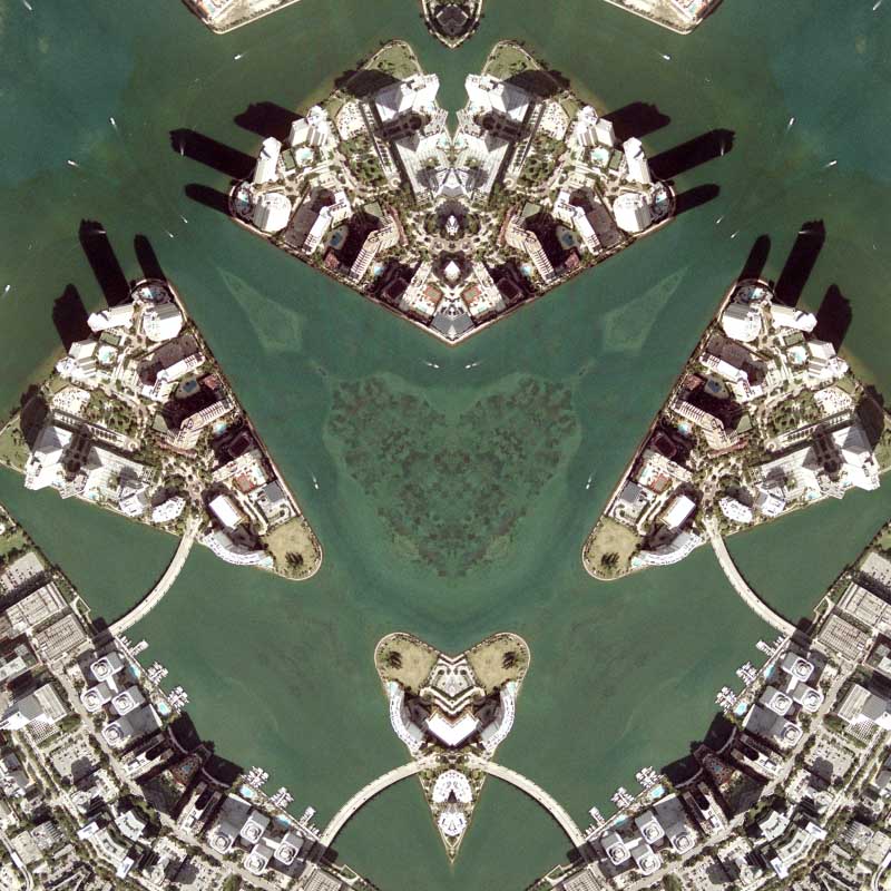
Like Providence, I have yet to visit downtown Houston, however I can still manipulate the city to some degree. Today’s degree is to the tune of about 60 :-) 360 divided by 60 equals 6 (which equals 3 lines of symmetry which I call “seams” of the quilt) and judging by my last quilts, I’ve found this number to be my favorite degree of manipulation.

So far I’ve made about 39 different quilts (multi-planar maps), and I think it is about time to begin the subdivision of the quilt project into the number seams each quilt has. This means I have to create a sub-category for each number of seams, and then go back through every blog entry and assign each quilt to it’s respective category. This will allow a casual visitor to this site the ability to look at all of the quilts at once or by each respective number of seams.

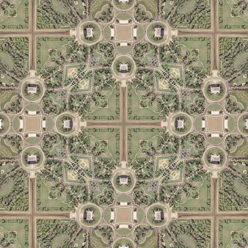
Starting at 2 seams, like the Ivan Memory (the first quilt) and Beverly Hills Quilt #3, then to 3 seams, like today’s quilt, and then quilts that have greater than 4 seams. This categorization of the quilt project will be helpful in the long run because it will show the ways the geographic tessellations react when reflected multiple times and more importantly it will help organize what has been my favorite projection of 2005.

As for Houston Quilt, the imagery is from 2002 from the USGS (of course!) and I modified the imagery in such a way that the center of the tessellation is Highway 45 and the high-rise buildings of downtown Houston surround it.

The drawback of this imagery, similar to my Denver imagery, is that the aerial photograph was taken in the afternoon and due to the angle of illumination, the shadows obscure much of the ground. Yet this can also be a nice aspect too because the shadows also reflect and make the rendering special in their own way.

I’d rather have the photograph taken from nadir (straight above) at noon on cloudless, sunny day (this eliminates shadows and distortion at the center of the scene). But of course that would be too easy right? :-)

The other drawback is that the imagery itself is somewhat devoid of colors. Granted the sensors did pick up colors, but they are not very vibrant. When looking at the map above it almost appears to be black & white, but when you look at the details you can see some color.

Maybe I should go in and modify the imagery again and add color? In the past, the closest I’ve gotten to doing that was embedding my name into the imagery, and that wasn’t that special. The Boston imagery is still some of my favorite imagery because of the color variations and the good news it that I also downloaded imagery of downtown Houston from 2004 which has an interesting patch of different colored imagery in. When tessellated, this imagery will add that colorful dimension this map currently lacks. First I have to prepare the imagery and I think I might just make another map using the Houston imagery. I was thinking of maybe a 2 seamed map or should it be 4? I’ll find out soon!

==Update==
I ultimately used the geometric shape instead of the lines of symmetry for my naming convention.

View Details:

+ MORE


The Daily Render By
A Digital Scrapbook for the Past, Present, and Future.

©2004-2023 Nikolas R. Schiller - Colonist of the District of Columbia - Privacy Policy - Fair Use - RSS - Contact


::LAST 51 POSTS::

Fair Use


52 queries. 0.721 seconds.
Powered by WordPress

Photo by Charlie McCormick
Nikolas Schiller is a second-class American citizen living in America's last colony, Washington, DC. This blog is my on-line repository of what I have created or found on-line since May of 2004. If you have any questions or comments, please contact:

If you would like to use content found here, please consult my Fair Use page.

::THE QUILT PROJECTION::

Square
Square

Diamond
diamond

Hexagon
hexagon

Octagon
octagon

Dodecagon
Dodecagon

Beyond
beyond

::OTHER PROJECTIONS::

The Lenz Project
Lenz

Mandala Project
Mandala

The Star Series


Abstract Series
abstract

Memory Series
Memory

Mother Earth Series
Mother Earth

Misc Renderings
Misc

::POPULAR MAPS::

- The Los Angeles Interchanges Series
- The Lost Series
- Terra Fermi
- Antique Map Mashups
- Google StreetView I.E.D.
- LOLmaps
- The Inaugural Map
- The Shanghai Map
- Ball of Destruction
- The Lenz Project - Maps at the Library of Congress
- Winner of the Everywhere Man Award

::MONTHLY ARCHIVES::


::LOCATIONS & CATEGORIES::

  • 2004 Elections (2)
  • 2008 Elections (35)
  • 2014 Elections (4)
  • 2016 Elections (2)
  • ACLU (3)
  • Activism (287)
  • Adbusters (13)
  • Advertisements (33)
  • aerial photography (19)
  • Analysis (31)
  • Animals (30)
  • animated gif (7)
  • Animation (25)
  • Antique (104)
  • Apple (1)
  • Arabic (17)
  • Architectural Archeology (9)
  • Artomatic (25)
  • Astronomy (15)
  • Astrophotography (9)
  • Audio (2)
  • Awards (3)
  • Backpacking (2)
  • banner graphics (5)
  • Beat Google to the Map (56)
  • bicycle (23)
  • Birds-Eye View (5)
  • Blaeu (10)
  • Book Covers (7)
  • Bridge (10)
  • Building (15)
  • calendar (28)
  • calligraphy (6)
  • Capital (61)
  • Cars (18)
  • Cartography (74)
  • Cartoon (9)
  • Celestial (31)
  • Censorship (32)
  • Chinese (7)
  • Chronicling America (34)
  • Classroom (5)
  • Clothing (12)
  • Commentary (76)
  • Commissioned (27)
  • Credit Cards (3)
  • Crime (12)
  • Cyrillic Alphabet (1)
  • DAILY LINKS (30)
  • Dance (2)
  • DC History (93)
  • Design (102)
  • Digital Scrap (5)
  • Election (11)
  • ESA (3)
  • Facebook (19)
  • Fantasy (3)
  • Fashion (23)
  • Fast Food (2)
  • FBI (7)
  • Flag (15)
  • flickr (4)
  • Found Map (56)
  • French (9)
  • Gallery (54)
  • Gardening (25)
  • General (256)
  • George Bush (12)
  • GIS (69)
  • GMO Labeling (4)
  • Google (31)
  • Google AdSense (4)
  • Google AdWords (3)
  • Google Earth (28)
  • Google Maps (47)
  • Google Reader (4)
  • Google Streetview (8)
  • GPS (7)
  • Graffiti (5)
  • Greek (4)
  • Green (72)
  • Green Party (18)
  • Healthcare (15)
  • Highway (35)
  • Hiking (2)
  • Hipster (2)
  • history (151)
  • Holidays (10)
  • House Party (2)
  • Hubble Telescope (2)
  • Humor (88)
  • In The News (88)
  • Insects (2)
  • Interactive (74)
  • Interiors (4)
  • IP Trace (28)
  • Latin (22)
  • Law (15)
  • Lecture (11)
  • Legislation (19)
  • Library (21)
  • Library of Congress (66)
  • Location (1,018)
  • LOLMaps (3)
  • Mass Transit (6)
  • Memorandum (2)
  • meta-data (32)
  • Mobile Phone Applications (1)
  • Movie (3)
  • MrSID (4)
  • MSN (5)
  • Museum (5)
  • Music (48)
  • MySpace (6)
  • NASA (10)
  • National Archives (3)
  • News (182)
  • Obituary (2)
  • Oil (4)
  • Ornithology (4)
  • orthophotography (4)
  • OSCE (16)
  • Photography (134)
  • Poetry (18)
  • Portuguese (1)
  • postmodern (8)
  • QR code (9)
  • QTVR (4)
  • Radio (3)
  • Renderings (675)
  • RSS (3)
  • Seasons (12)
  • Sold (40)
  • Spanish (7)
  • Speech (5)
  • Sports (1)
  • Stadium (40)
  • statehood (94)
  • Statistics (2)
  • Stellarium (4)
  • Stereogram (1)
  • Street (21)
  • Street Art (10)
  • Submissions (5)
  • Tattoo (2)
  • Testimony (2)
  • time-lapse (19)
  • Torture (3)
  • Transportation (6)
  • TV (23)
  • Twitter (5)
  • University (41)
  • Update (24)
  • Vegetarianism (2)
  • Video (49)
  • Vimeo (18)
  • visualization (36)
  • Washington Critic (2)
  • Weather (19)
  • Web Crawler (9)
  • Wikipedia (14)
  • Wordpress (4)
  • Wordpress Upgrade (2)
  • World Wind (3)
  • Yahoo (6)
  • YouTube (113)
  • Zodiac (23)


  • thank you,
    come again!