The Daily Render

by

A Digital Scrapbook for the Past, Present, and Future

| FRONT PAGE | GEOSPATIAL ART | DC HISTORY / TIMELINE | NEWS | COLONIST | FOUND MAPS | FRACTALS |
| PHOTOGRAPHY | ANTIQUE | DESIGN | VIDEO | | CONTACT |

American Stereography #1
|| 3/15/2007 || 1:18 pm || Comments Off on American Stereography #1 || ||

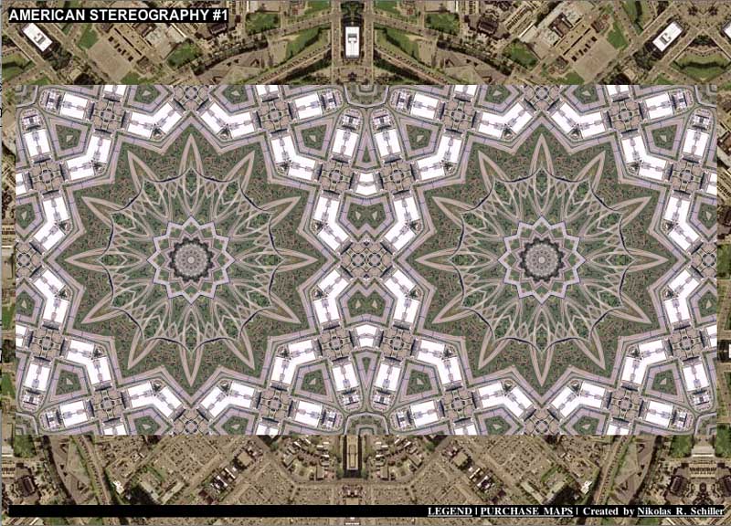
I mentioned before that I was working on a means to do stereo projections. Well it turned out to be easier than I thought. I simply had to make the random image be the same image displayed on the left and right. It’s not what I’d call perfect stereography, but it’s a good start. I plan on making at couple more of these using the details from the exact centers of the maps.

The pixels used in this interactive map are, follow me here, a 4,200 by 4,200 section from a 18,000 by 12,000 map made in 2006, reduced to 800 x 800, then reduced again to 400 x 400. The reductions are done so the map zoom-ins both fit on the screen. The first reduction is what you’ll find if you click on the (more..) link on my quilt projection blog entries. The second reduction is done via the HTML on the webpage so people with screen width’s less than 1600 pixels wide will be able to see the imagery side by side.

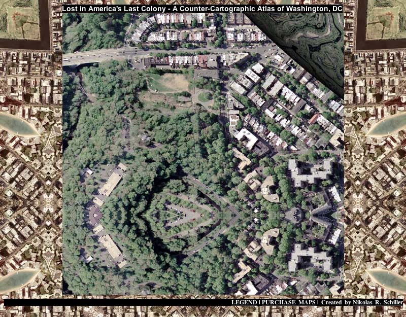
The background is the opposite of Lost in America’s Last Colony and features places & spaces in Washington, DC. I might remove this altogether to make it easier on the eyes….

–>Wikipedia on Stereoscopy


Interactive Inequality
|| 3/11/2007 || 10:23 pm || Comments Off on Interactive Inequality || ||

This interactive map is pretty simple. On the left are places around America and on the right are places in Washington, DC. Above each image I have written “CITIZENS” and “COLONISTS” to denote the fact that DC residents are second-class citizens who currently suffer taxation without representation.  Each time you click, you get two new locations in America, but because of geography, the people living in the respective locations are not equal.  Interactive Inequality.


Lost in America’s Last Colony
|| 3/10/2007 || 9:05 am || Comments Off on Lost in America’s Last Colony || ||

Click the image above to view my first map in the “Lost Series”

View the map’s Legend after the fold:

+ MORE


The Lost Series
|| 3/6/2007 || 2:02 am || Comments Off on The Lost Series || ||

Using the same php code that rotates my banners, I have begun to make my next generation of maps. Since I am not actively making too many new maps at the moment, I’ve decided to start dabbling with methods of displaying my maps.

Five files were placed on-line for nearly each map I made in 2006: the full-size map (18,000×12,000 pixels reduced to 1,200×800), a zoom-to the center (reduced from 4200×4200 pixels to 800×800 pixels), a direct zoom-in to the center (at 800×800 pixels), and two details picked randomly from somewhere on the map (Harvard Quilt – NE linked for visual explanation).

By copying these various files to new folders on my website I’ve developed a means to randomly select any of the five different files. The result is a series of interactive web pages that are defined by geography and type of cartographic detail. The main drawback to the php script I am using is that you never see the name of the map you are looking at. Paradoxically, this also means you really are lost in the maps. A compass will not help you much :)


Submitted Today: Cathedral Quilt – Signed [Web Biennial 07]
|| 2/5/2007 || 2:49 pm || Comments Off on Submitted Today: Cathedral Quilt – Signed [Web Biennial 07] || ||

Links to Interactive Geospatial Environment powered by Zoomify

Detail of Cathedral Quilt – Signed

I found the call for entries today and submitted this interactive web environment.


Park La Brea Quilt #3
|| 12/10/2006 || 5:40 pm || Comments Off on Park La Brea Quilt #3 || ||

: rendered at 18,000 X 12,000 :
Park La Brea Quilt by Nikolas Schiller

Park La Brea (Spanish: La Brea – The tar, after the nearby La Brea Tar Pits) is a sprawling apartment complex in the Miracle Mile District of Los Angeles, California. It encompasses more than 4,000 apartments in both high-rise and garden-style buildings, and sits on 160 acres (0.65 km2) of land with numerous lawns. It’s layout is geometric and lends itself to my map style. This is my third iteration of the series featuring the area around Park La Brea in Los Angeles, California. Its one of my favorites :-)

View the Google Map of Park La Brea, Los Angeles, California.

View Park La Brea Quilt #3 in an interactive web environment

View Details:

+ MORE


Temporal Stereography of Schiller Park, Illinois
|| 12/3/2006 || 4:47 pm || Comments Off on Temporal Stereography of Schiller Park, Illinois || ||

Tessellations of Time
Schiller Park Quilt 2002 || Schiller Park Quilt 2005

Some locations around the United States have high-resolution, color, aerial photography available from two specific periods of time, some entire states have none. Washington, DC has imagery of 2002 and 2005, however the 2005 imagery has not been released to public (I’m still waiting to see if NO WAR shows up on my roof!). All of my DC maps use the Feb 2002 imagery. Google currently uses imagery of Washington, DC that was taken probably in March or April of 2002 because the Mandarin Oriental Hotel is still semi-completed in both sets of imagery.

Chicago, on the other hand, also has available imagery taken in April of 2002 and April of 2005. So I obtained both years for the Village of Schiller Park, Illinois, which is located right outside of Chicago’s O’Hare airport. When preparing the imagery I made sure that they were identical tessellations, differing only in acquisition date. I attempted to match the tone as best as I could.

The idea behind this process was that when printed and hung next to each other, they would create a rudimentary stereoscopic projection that would look largely similar, but with temporal artifacts showing change in the built environment.

The one regret is rendering the maps at 9K x 6K instead of the normal 18K x 12K, I would have captured more detail from the source aerial photography. But aside from that, I am going to make more of these temporal diptychs when the imagery is available. I think it’s a unique method of showing time, space, place, and symmetry.

Ironically, even though both sets of imagery present Schiller Park in the recent past, those of you in Chicago are technically seeing the future, because Google will most likely update their servers with the same imagery I’m using. So in reality, you are looking at a map of the future!

Left = 2002 || Right = 2005

Look closely and watch time bend.

+ MORE


Gimmicky Green Party Google Maps
|| 8/1/2006 || 11:58 am || Comments Off on Gimmicky Green Party Google Maps || ||

Tonight’s creation….

Jon Q. Voter: “What does the Green Party stand for?”
Me: “Well there are 10 Key Values…”
Jon Q. Voter: “Environment right?”
Me: “Well, I prefer ‘ecologicial wisdom,’ but that is one of them.”
Jon Q. Voter: “What are the rest?”
Me: “Well I made a nifty google map to help you.”

10 Key Value Google Map” – click image to be taken to the map


106 Maps in 2004
|| 6/24/2006 || 2:14 am || Comments Off on 106 Maps in 2004 || ||

2004 features the creation of the Lenz Project, the Star Series, the Abstract Series, the Mother Earth Series and the Memory Series, as well as a few animations and my first interactive maps. See below for links to all of the maps of 2004.

The Lenz Project
Begun June 25th, 2004

More information about the Lenz Project(ion) below.

DC Lenz #2
Lake Reflect Cube Lenz
Kamache Cube Lenz
Himalaya Cube Lenz
Baghdad Cube Lenz
Monrovia Cube Lenz
Dutch Cube Lenz
Vortex Cube Lenz
Ganges Cube Lenz
Ivan Cube Lenz
Ballwin Bubble #2
Ballwin Bubble
Greenzone Full Lenz
Brussels Lenz #5
Dutch Full Lenz
Bissau Full Lenz
Ganges Himalay Guinea-Bissau Lenz
Greenzone #5
Kamanche Bissau Lenz
Vortex Spin #2
Vortex Spin
Vortex Lenz
Bolivia Lenz
Ganges Reflect Lenz
Ganges Lenz
Brussels Random Lenz
Kamanche Lenz
Namib Lenz
Dutch NYC Lenz #3
Dutch NYC Lenz #2
Dutch NYC Lenz
Dutch Bissau Lenz #2
Dutch Bissau Lenz
NYC Bissau Reflect Lenz
Bissau Lake Inner Reflect Lenz
Himalaya Brussels Lenz
Brussels Invert Lenz
Himalaya Invert Lenz
Bissau Invert Inner Lenz
Bissau Monrovia Lenz
Bissau Black Lenz
Inner Lake Lenz
Himalaya Bissau Lenz
Guinea-Bissau Lenz
Guinea-Bissau Lenz #2
Baghdad Bissau Lenz
Baghdad Bissau Lenz #2
Baghdad Lake Lenz
Baghdad Monrovia Eye
Baghdad Monrovia Lenz
Brussels Lenz
Brussels Lenz #2
Brussels Eye
Earth Eye Monrovia Black Lenz
Earth Eye Monrovia Total Lenz
Earth Lenz Monrovia
Earth Eye Monrovia
Earth Eye Reflection
Earth Eye
Fire Eye
Fire Lenz
Istanbul Eye
False Color Eye
Recycle Lenz
Mecca Lenz
Mecca Aqua Lenz
Moon Lenz
Pentagon Lenz
Statue of Liberty Lenz
Vatican Lenz
Iraq Lenz
Vatican Lenz #2
Abu Ghraib Lenz
Baghdad Lenz
Bora Bora Lenz
DC Lenz
DC Torus Lenz

About the Lenz Project(ion)
The Lenz Project was started in June of 2004 at my residence in the Shaw neighborhood in Washington, DC. Begun shortly after finishing my studies at the George Washington University, I began to plot the concept of being a square peg in a round hole (Living in Washington, DC). The Lenz Projection was born as a cartographic emotional response to finding myself and what I wanted to become. The answer, after nearly 77 maps, was inorder to fit in, I must focus.

The Lenz Projection is based on 4 simple items:
– Aerial or satellite image
– Torus (a donut)
– Transparent glass sphere
– Light source

The Lenz Projection was setup as follows:

– A light source is created to illuminate the scene
– The aerial or satellite image was placed in the direct center of the scene (the square peg)
– The Torus placed at the center of the scene and reduced so that the image fits exactly in the center (the square peg in a round hole)
– The transparent glass sphere was place at the center of the scene enclosing the image and half the diameter of the torus (Lenz)

By adjusting the the Z dimension (depth) of the transparent glass sphere over the square image in the circle, the Lenz causes the imagery to refract and fill the space of the circle. Thus by focusing the Lenz on a given space, the square peg becomes round. View this animation for a side by side comparison of how the Lenz refracts.

From June 20th, 2004 until October 19th, 2004 the maps below were created or a near daily basis. Due to the pace of my cartographic production, I gave my cartographic journal the title “The Daily Render.” The end of the Lenz Project came with the completion of DC Lenz #2 because I felt that I had created the best Lenz Projection to date and I was ready to begin experimenting with different shapes and dimensions. Through the process I had discovered quite a bit about myself and the means to project geospatial information. While this stage of the Lenz project had finished, I’ve continued to make maps using the perfected Lenz Projection template.

Some of the early maps in the Lenz Projection used copyrighted satellite imagery. At the time of their creation I was unaware of what imagery was legal and illegal to use. I discovered that all for-profit corporations forbid the modification of the pixels of the satellite image. I also discovered that there are some sources of public domain imagery that allow for the creation of derivative products. Starting in late 2004 all of my maps are composed of only public domain imagery, however I chosen to keep my early maps on-line for educational purposes.

Other Maps from 2004:
E Street Risk Analysis (Interactive)
Personal Card
Brussels Lenz (Animation)
U Street Development (Interactive)
Nambib Lenz (Animation)
Flower for Jerusalem
Flower & Sun
False Color Grid (Detail)
3D Lenz (Interactive)
Brussels Lenz 3D (Interactive)
Dutch Bissau Lenz 3D (Interactive)
Post 911 ReflectionDelta

Middle East Reflection
Mississippi Delta Reflection Balls
Star of the Mississippi River Delta
Star of Bissau
Star of the Ganges River
Star of Brussels
Star of Saint Louis
Abstract Netherlands
Abstract DC
Abstract Brussels
Abstract Saint Louis
Mother Earth #1
Mother Earth (Animation)
Mother Earth #2
Mother Earth #3
Star of DC
U Street Popular Locations (Interactive)
U.S. Naval Observatory Lenz

Related:
95 Maps in 2008
305 Maps in 2007
213 Maps in 2006
122 Maps in 2005


Taxation Without Representation Google Map
|| 6/14/2006 || 10:07 pm || Comments Off on Taxation Without Representation Google Map || ||

Happy Flag Day!

This google map plots 51 DC flags around the U.S. Capitol. When the flags are clicked a random fact about America’s last continental colony pops up. You can open the source HTML to read them all quickly. I obtained some of the facts and figures from DC Vote and I sent the list out to the members of the DC Statehood Green Party for feedback. The result is what I think is one of the first political google map mashups. Have fun!


The Daily Render By
A Digital Scrapbook for the Past, Present, and Future.

©2004-2023 Nikolas R. Schiller - Colonist of the District of Columbia - Privacy Policy - Fair Use - RSS - Contact


::LAST 51 POSTS::

Fair Use


53 queries. 0.712 seconds.
Powered by WordPress

Photo by Charlie McCormick
Nikolas Schiller is a second-class American citizen living in America's last colony, Washington, DC. This blog is my on-line repository of what I have created or found on-line since May of 2004. If you have any questions or comments, please contact:

If you would like to use content found here, please consult my Fair Use page.

::THE QUILT PROJECTION::

Square
Square

Diamond
diamond

Hexagon
hexagon

Octagon
octagon

Dodecagon
Dodecagon

Beyond
beyond

::OTHER PROJECTIONS::

The Lenz Project
Lenz

Mandala Project
Mandala

The Star Series


Abstract Series
abstract

Memory Series
Memory

Mother Earth Series
Mother Earth

Misc Renderings
Misc

::POPULAR MAPS::

- The Los Angeles Interchanges Series
- The Lost Series
- Terra Fermi
- Antique Map Mashups
- Google StreetView I.E.D.
- LOLmaps
- The Inaugural Map
- The Shanghai Map
- Ball of Destruction
- The Lenz Project - Maps at the Library of Congress
- Winner of the Everywhere Man Award

::MONTHLY ARCHIVES::


::LOCATIONS & CATEGORIES::

  • 2004 Elections (2)
  • 2008 Elections (35)
  • 2014 Elections (4)
  • 2016 Elections (2)
  • ACLU (3)
  • Activism (287)
  • Adbusters (13)
  • Advertisements (33)
  • aerial photography (19)
  • Analysis (31)
  • Animals (30)
  • animated gif (7)
  • Animation (25)
  • Antique (104)
  • Apple (1)
  • Arabic (17)
  • Architectural Archeology (9)
  • Artomatic (25)
  • Astronomy (15)
  • Astrophotography (9)
  • Audio (2)
  • Awards (3)
  • Backpacking (2)
  • banner graphics (5)
  • Beat Google to the Map (56)
  • bicycle (23)
  • Birds-Eye View (5)
  • Blaeu (10)
  • Book Covers (7)
  • Bridge (10)
  • Building (15)
  • calendar (28)
  • calligraphy (6)
  • Capital (61)
  • Cars (18)
  • Cartography (74)
  • Cartoon (9)
  • Celestial (31)
  • Censorship (32)
  • Chinese (7)
  • Chronicling America (34)
  • Classroom (5)
  • Clothing (12)
  • Commentary (76)
  • Commissioned (27)
  • Credit Cards (3)
  • Crime (12)
  • Cyrillic Alphabet (1)
  • DAILY LINKS (30)
  • Dance (2)
  • DC History (93)
  • Design (102)
  • Digital Scrap (5)
  • Election (11)
  • ESA (3)
  • Facebook (19)
  • Fantasy (3)
  • Fashion (23)
  • Fast Food (2)
  • FBI (7)
  • Flag (15)
  • flickr (4)
  • Found Map (56)
  • French (9)
  • Gallery (54)
  • Gardening (25)
  • General (256)
  • George Bush (12)
  • GIS (69)
  • GMO Labeling (4)
  • Google (31)
  • Google AdSense (4)
  • Google AdWords (3)
  • Google Earth (28)
  • Google Maps (47)
  • Google Reader (4)
  • Google Streetview (8)
  • GPS (7)
  • Graffiti (5)
  • Greek (4)
  • Green (72)
  • Green Party (18)
  • Healthcare (15)
  • Highway (35)
  • Hiking (2)
  • Hipster (2)
  • history (151)
  • Holidays (10)
  • House Party (2)
  • Hubble Telescope (2)
  • Humor (88)
  • In The News (88)
  • Insects (2)
  • Interactive (74)
  • Interiors (4)
  • IP Trace (28)
  • Latin (22)
  • Law (15)
  • Lecture (11)
  • Legislation (19)
  • Library (21)
  • Library of Congress (66)
  • Location (1,018)
  • LOLMaps (3)
  • Mass Transit (6)
  • Memorandum (2)
  • meta-data (32)
  • Mobile Phone Applications (1)
  • Movie (3)
  • MrSID (4)
  • MSN (5)
  • Museum (5)
  • Music (48)
  • MySpace (6)
  • NASA (10)
  • National Archives (3)
  • News (182)
  • Obituary (2)
  • Oil (4)
  • Ornithology (4)
  • orthophotography (4)
  • OSCE (16)
  • Photography (134)
  • Poetry (18)
  • Portuguese (1)
  • postmodern (8)
  • QR code (9)
  • QTVR (4)
  • Radio (3)
  • Renderings (675)
  • RSS (3)
  • Seasons (12)
  • Sold (40)
  • Spanish (7)
  • Speech (5)
  • Sports (1)
  • Stadium (40)
  • statehood (94)
  • Statistics (2)
  • Stellarium (4)
  • Stereogram (1)
  • Street (21)
  • Street Art (10)
  • Submissions (5)
  • Tattoo (2)
  • Testimony (2)
  • time-lapse (19)
  • Torture (3)
  • Transportation (6)
  • TV (23)
  • Twitter (5)
  • University (41)
  • Update (24)
  • Vegetarianism (2)
  • Video (49)
  • Vimeo (18)
  • visualization (36)
  • Washington Critic (2)
  • Weather (19)
  • Web Crawler (9)
  • Wikipedia (14)
  • Wordpress (4)
  • Wordpress Upgrade (2)
  • World Wind (3)
  • Yahoo (6)
  • YouTube (113)
  • Zodiac (23)


  • thank you,
    come again!