
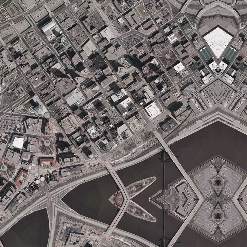
It’s been quite a long time since I’ve made one of my signature quilt projection maps. On one hand I haven’t been inspired lately to make any new maps based on this technique. On the other hand, there are only a few American cities that I have yet to map, and Saint Paul, Minnesota was one of them. I was originally going to make this map during the Republican National Convention, but was sidetracked due to other work. Unlike the previous quilt projection maps that I have made most recently, which involved at least one recursive tessellation, this map employs the original style of my hexagon quilts.
This coming Saturday I will be in New York City for the New York Map Society’s monthly meeting. In preparation for my talk, I don’t expect to be blogging much this week because I intend on spending much of my spare time preparing my notes for the talk. If you are in New York, I hope you can make it!
View the Google Map of downtown Saint Paul, Minnesota.
View the rest of the details:


Related Minnesota Entries:
- The Representative Woman’s Point of View: An Interview with Susan B. Anthony – By Emma Horn Harris, The Saint Paul Globe, May 01, 1904
- Statehood for the District of Columbia - The Minneapolis Star and Tribune, June 27th, 1987
- Saint Paul Quilt
- Protest videos from the first day of the RNC in St. Paul, Minnesota
- I-35W Bridge Quilt #2
- "Ghost Cars" on the I-35W Bridge
- I-35W Bridge Quilt
- Minneapolis Quilt #2
- Minneapolis Sunrise
- The Quilt Project / Minneapolis Quilt
- Minneapolis Memory


