The Daily Render

by

A Digital Scrapbook for the Past, Present, and Future

| FRONT PAGE | GEOSPATIAL ART | DC HISTORY / TIMELINE | NEWS | COLONIST | FOUND MAPS | FRACTALS |
| PHOTOGRAPHY | ANTIQUE | DESIGN | VIDEO | | CONTACT |

Boston Common Quilt
|| 4/17/2008 || 6:59 pm || Comments Off on Boston Common Quilt || ||

: rendered at 18,000 X 12,000 :
Boston Commons Quilt

I’ve had a couple geographers contact me asking if I was attending the AAG’s annual meeting in Boston. My answer has been that I’m too busy on various projects to attend. As a former employee and someone who helped facilitate two annual meetings (Denver & Chicago), I realized that the next meeting I plan on attending will be as either an exhibitor or if the trip is paid for by an employer. I would like to give another presentation again or organize a panel discussion, but, as with most things in life, I’m in no hurry.

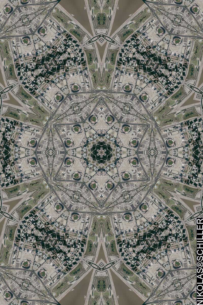
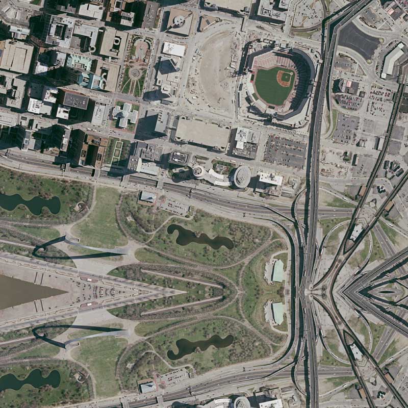
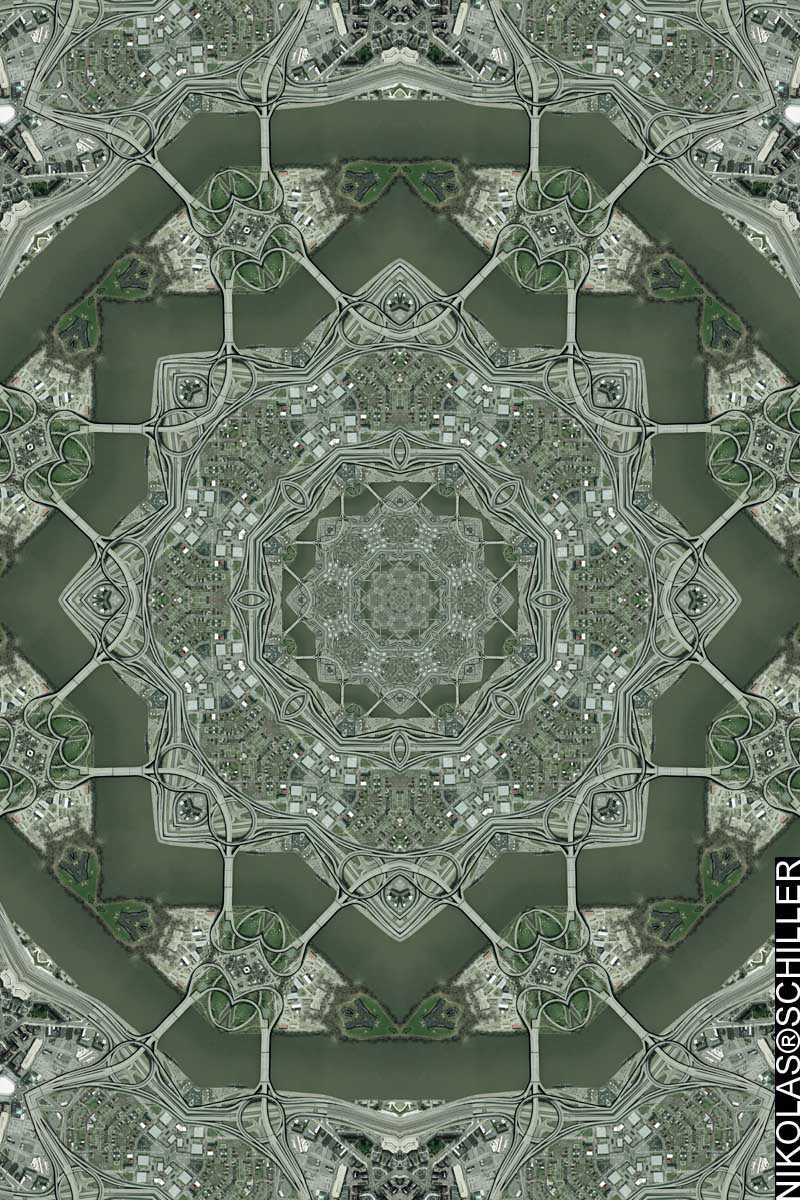
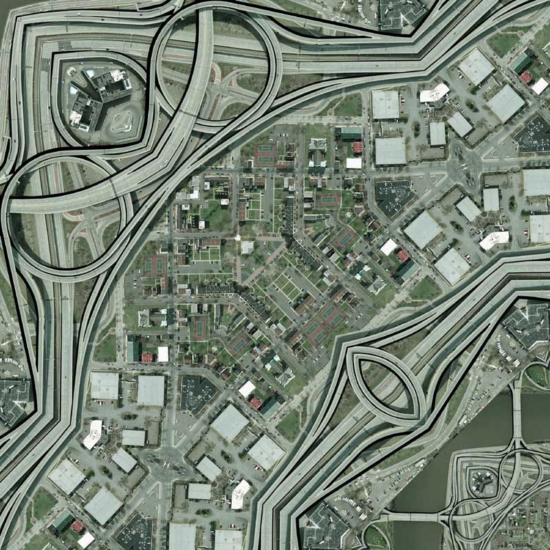
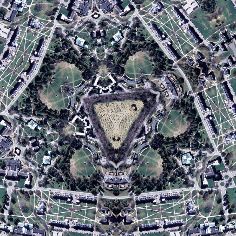
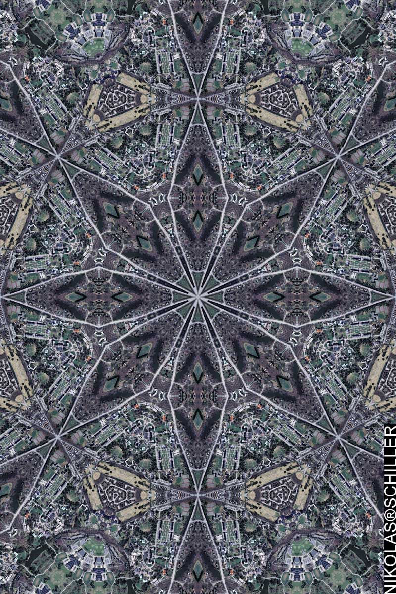
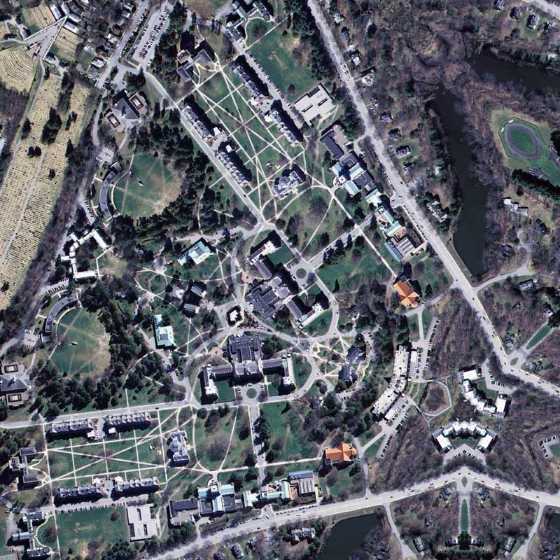
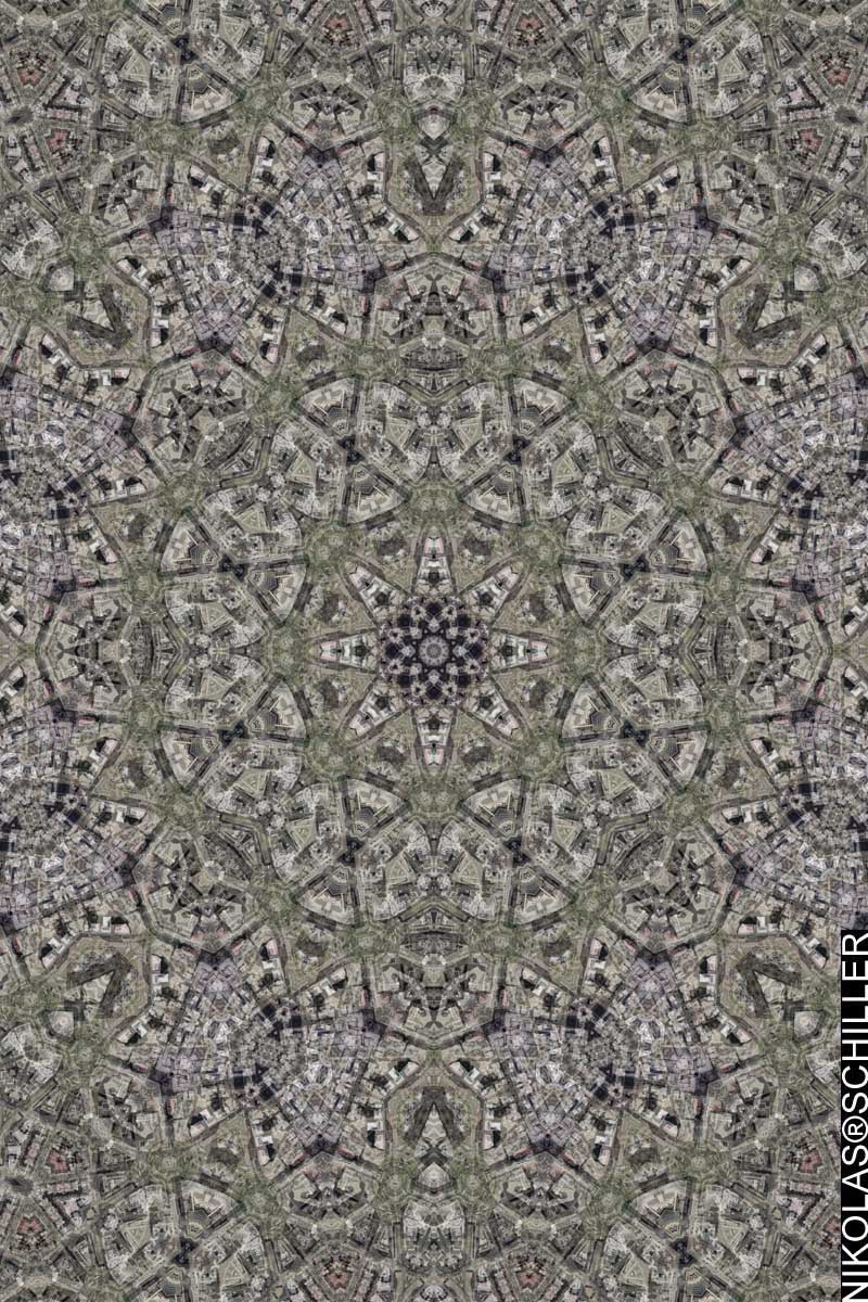
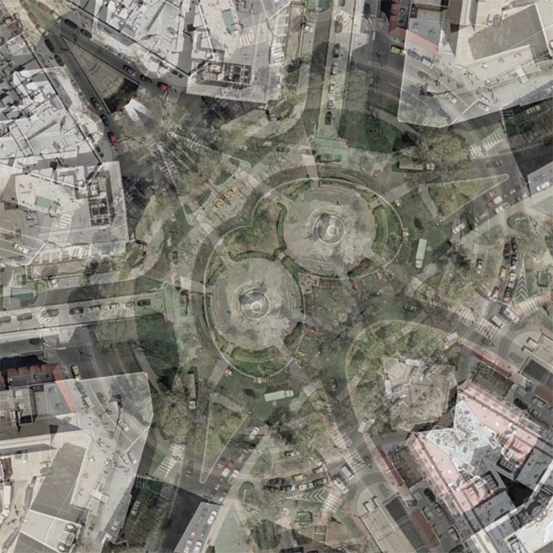
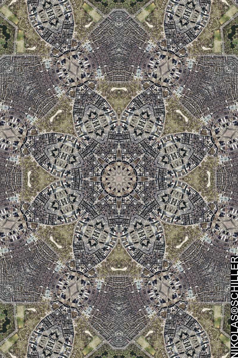
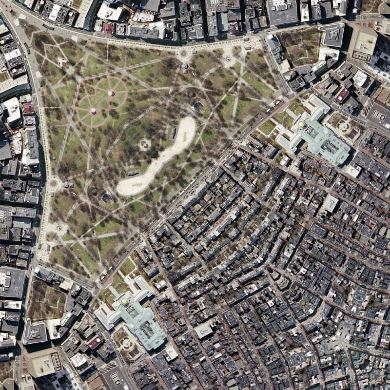
Since I have not made any maps of downtown Boston since August of 2005, I decided to download the city, in lieu of going to the city. Pleasantly, I was able to download the city at two different spatial scales and from two different years: 2004 & 2005. So far the imagery looks a lot better than the patchwork design that was previously placed into the public domain. Eight different tessellations later, the entire downtown area will be remapped in the next week. Today’s map features the area around Boston Common, which is the oldest public park in America (created in 1634), and the Massachusetts State House. I chose an Octagon Quilt Projection because I liked the way the center creates a compass rose. Up next will be a derivative of today’s map.

View the Google Map of Boston Common in Boston, Massachusetts.

View the rest of the details:

+ MORE


Saint Louis Quilt #5
|| 4/6/2008 || 11:48 am || Comments Off on Saint Louis Quilt #5 || ||

: rendered at 18,000 X 12,000 :
Saint Louis Quilt #5

This map of downtown Saint Louis, Missouri is the first to use imagery from 2006. I have now made maps of downtown Saint Louis that show the downtown area at three specific periods in time in the last 6 years. In the near future, I might made a montage of how the geography has changed using familiar portions of these maps. It think it would look very interesting. As I mentioned before, I like the way that I’ve been able to capture the Busch Stadium’s progression over time.

View the Google Map of downtown Saint Louis, Missouri.

View the rest of the details:

+ MORE


Memphis Cross
|| 4/5/2008 || 5:52 pm || Comments Off on Memphis Cross || ||

: rendered at 18,000 X 12,000 :
Memphis Cross

Yesterday was the 40th anniversary of the assassination of Dr. Martin Luther King and I decided to make a map the area around the site of the memorial. I made a similar cross a month ago using imagery from the Mount Pleasant neighborhood in Washington, DC and another cross-like map in the summer of 2005. Upon comparing the three, I feel that Mount Pleasant Cross looks more like a traditional cross because the reflection on 16th street forms the familiar shape. When preparing the imagery I adjusted the line of symmetry in the source tessellation to create a near perfect stadium reflection. In the current Google Maps imagery, which is newer than this map’s imagery, the dome of the stadium has Fedex Field printed across the top. Fortunately, the illusion of the symmetrical stadium was not ruined by corporate branding.

View the Google Map of Memphis, Tennessee.

Lorraine Motel / National Civil Rights Museum Detail

View the rest of the details:

+ MORE


Saint Louis Quilt #4
|| 4/3/2008 || 4:26 pm || Comments Off on Saint Louis Quilt #4 || ||

: rendered at 18,000 X 12,000 :
Saint Louis Quilt #4

Unlike the previous three maps of Saint Louis which use imagery from 2002, this map uses poor quality imagery from 2005. I really like how the old Busch Stadium shows up and the new Busch Stadium is still being constructed. Up next will be another map of downtown Saint Louis, but will feature better quality aerial photography from 2006 and the new Busch Stadium. The 2006 aerial photography was used in my Geospatial Natal Chart that I made in December, as well as the two most recent maps of my childhood neighborhood in Ballwin, Missouri.

View the Google Map of downtown Saint Louis, Missouri.

View the rest of the details:

+ MORE


Albany Droste Quilt
|| 3/31/2008 || 3:49 pm || Comments Off on Albany Droste Quilt || ||

: rendered at 18,000 X 12,000 :
Vassar Quilt #2

I’ve made similar Droste-like maps before that are multi-scalar, but this is the first to follow “rules” involved in creating the Droste Effect. To achieve this effect I cut out an octagon out of the center of the map and pasted a 34% reduced duplicate of the map within the octagon. This recursive process allows for multiple internal repetitions because the source map is very large in size (216 megapixels).

View the Google Map of downtown Albany, New York.

View the rest of the details:

+ MORE


Hello Cherubs – A New Splash Page Graphic Added
|| 3/30/2008 || 1:37 pm || Comments Off on Hello Cherubs – A New Splash Page Graphic Added || ||

With the addition of this graphic, my website’s splash page now contains over 18,675 different visual combinations. I’ve been working on a new lost series project called “The Grand Juxtaposition,” which uses all the images of my website. It should be ready in a week or two. This new splash page graphic was created using the letter z from the Oktober 98 font collection. I colored in the image and removed the color on the book’s page to create a transparency illusion that the book has been opened to one page somewhere on my website. Just hit reload to cycle through the different visual combinations.

Above the cherubs are showing a zoom-in detail of Washington Circle Quilt


Vassar Quilt Refraction
|| 3/28/2008 || 3:46 pm || Comments Off on Vassar Quilt Refraction || ||

: rendered at 15,000 X 10,000 :
Vassar Quilt Refraction

Using this portion of Vassar Quilt #2, I made this derivative map of Vassar College using added elements from the Lenz projection. The optics create a very unique sense of depth at the center of the map. I also added four other optical elements that create a fluvial design, almost appearing to flow toward the center.

View the Google Map of Vassar College in Poughkeepsie, New York.

View the rest of the details:

+ MORE


Vassar Quilt #2
|| || 3:28 pm || Comments Off on Vassar Quilt #2 || ||

: rendered at 18,000 X 12,000 :
Vassar Quilt #2

Using this portion of Vassar Quilt, I made this derivative map of Vassar College. For more information about this imagery see my previous posting or read the metadata. There will be a third map in this series that is vastly different than the previous two. It should be on-line shortly.

View the Google Map of Vassar College in Poughkeepsie, New York.

View the rest of the details:

+ MORE


Vassar Quilt
|| 3/26/2008 || 5:18 pm || Comments Off on Vassar Quilt || ||

: rendered at 18,000 X 12,000 :
Vassar Quilt

Continuing my ongoing project of mapping various colleges, schools, and universities around the United States, I decided to follow-up Mount Holyoke College with Vassar College. According to the metadata, the aerial photography was taken in 2004, scanned at 1 foot per pixel in early 2006, and released to the public in December, 2006. I have prepared another tessellation for Vassar and will make a derivative follow-up map.

View the Google Map of Vassar College in Poughkeepsie, New York.

View the rest of the details:

+ MORE


Scott + Dupont Circle Quilt
|| 3/18/2008 || 1:07 pm || 1 Comment Rendered || ||

: rendered at 18,000 X 12,000 :
Scott + Dupont Circle Quilt

Continuing my current project of mapping the portions of Washington, DC that Google is censoring, I decided use the same process that was used to create Washington + Dupont Circle Quilt. This type of digitally derived double exposure aerial photography creates some of my favorite maps as of late. While I am only touching on the germane juxtaposition of traffic circles in Washington, DC, I’ve been thinking about how I take two completely disparate geographies and create similar styled maps. One idea is to take two of the tessellations I created for the Los Angeles Interchanges Series and create a double exposure highway interchange. Another possibility is to make a Supreme Illusion Supreme by overlaying the Pentagon on to the site of the World Trade Center. I’m not sure how it would look, but I think I’ll try making one of these maps in the near future.

View the Google Map of Scott Circle in Washington, DC.
View the Google Map of Dupont Circle in Washington, DC.

View the rest of the details:

+ MORE


The Daily Render By
A Digital Scrapbook for the Past, Present, and Future.

©2004-2026 Nikolas R. Schiller - Former Colonist of the District of Columbia - Privacy Policy - Fair Use - RSS - Contact


::LAST 51 POSTS::

Fair Use


53 queries. 3.149 seconds.
Powered by WordPress

Photo by Charlie McCormick
Hello! Thanks for stopping by! My name is Nikolas Schiller. I am an American citizen currently living in New York City and working remotely to support structural change in Washington, DC.

This blog is my online repository of what I have created or found online since May of 2004. I've been on hiatus since 2018 but plan on contributing more content in the not so distant future.

If you have any questions or comments, please contact:

If you would like to use content found here, please consult my Fair Use page.

::THE QUILT PROJECTION::

Square
Square

Diamond
diamond

Hexagon
hexagon

Octagon
octagon

Dodecagon
Dodecagon

Beyond
beyond

::OTHER PROJECTIONS::

The Lenz Project
Lenz

Mandala Project
Mandala

The Star Series


Abstract Series
abstract

Memory Series
Memory

Mother Earth Series
Mother Earth

Misc Renderings
Misc

::POPULAR MAPS::

- The Los Angeles Interchanges Series
- The Lost Series
- Terra Fermi
- Antique Map Mashups
- Google StreetView I.E.D.
- LOLmaps
- The Inaugural Map
- The Shanghai Map
- Ball of Destruction
- The Lenz Project - Maps at the Library of Congress
- Winner of the Everywhere Man Award

::MONTHLY ARCHIVES::


@NikolasSchiller

::LOCATIONS & CATEGORIES::

  • 2004 Elections (2)
  • 2008 Elections (35)
  • 2014 Elections (4)
  • 2016 Elections (2)
  • ACLU (3)
  • Activism (287)
  • Adbusters (13)
  • Advertisements (33)
  • aerial photography (19)
  • Analysis (31)
  • Animals (30)
  • animated gif (7)
  • Animation (25)
  • Antique (104)
  • Apple (1)
  • Arabic (17)
  • Architectural Archeology (9)
  • Artomatic (25)
  • Astronomy (15)
  • Astrophotography (9)
  • Audio (2)
  • Awards (3)
  • Backpacking (2)
  • banner graphics (5)
  • Beat Google to the Map (56)
  • bicycle (23)
  • Birds-Eye View (5)
  • Blaeu (10)
  • Book Covers (7)
  • Bridge (10)
  • Building (15)
  • calendar (28)
  • calligraphy (6)
  • Capital (61)
  • Cars (18)
  • Cartography (74)
  • Cartoon (9)
  • Celestial (31)
  • Censorship (32)
  • Chinese (7)
  • Chronicling America (34)
  • Classroom (5)
  • Clothing (12)
  • Commentary (76)
  • Commissioned (27)
  • Credit Cards (3)
  • Crime (12)
  • Cyrillic Alphabet (1)
  • DAILY LINKS (30)
  • Dance (2)
  • DC History (93)
  • Design (102)
  • Digital Scrap (5)
  • Election (11)
  • ESA (3)
  • Facebook (19)
  • Fantasy (3)
  • Fashion (23)
  • Fast Food (2)
  • FBI (7)
  • Flag (15)
  • flickr (4)
  • Found Map (56)
  • French (9)
  • Gallery (54)
  • Gardening (25)
  • General (256)
  • George Bush (12)
  • GIS (69)
  • GMO Labeling (4)
  • Google (31)
  • Google AdSense (4)
  • Google AdWords (3)
  • Google Earth (28)
  • Google Maps (47)
  • Google Reader (4)
  • Google Streetview (8)
  • GPS (7)
  • Graffiti (5)
  • Greek (4)
  • Green (72)
  • Green Party (18)
  • Healthcare (15)
  • Highway (35)
  • Hiking (2)
  • Hipster (2)
  • history (151)
  • Holidays (10)
  • House Party (2)
  • Hubble Telescope (2)
  • Humor (88)
  • In The News (88)
  • Insects (2)
  • Interactive (74)
  • Interiors (4)
  • IP Trace (28)
  • Latin (22)
  • Law (15)
  • Lecture (11)
  • Legislation (19)
  • Library (21)
  • Library of Congress (66)
  • Location (1,018)
  • LOLMaps (3)
  • Mass Transit (6)
  • Memorandum (2)
  • meta-data (32)
  • Mobile Phone Applications (1)
  • Movie (3)
  • MrSID (4)
  • MSN (5)
  • Museum (5)
  • Music (48)
  • MySpace (6)
  • NASA (10)
  • National Archives (3)
  • News (182)
  • Obituary (2)
  • Oil (4)
  • Ornithology (4)
  • orthophotography (4)
  • OSCE (16)
  • Photography (134)
  • Poetry (18)
  • Portuguese (1)
  • postmodern (8)
  • QR code (9)
  • QTVR (4)
  • Radio (3)
  • Renderings (675)
  • RSS (3)
  • Seasons (12)
  • Sold (40)
  • Spanish (7)
  • Speech (5)
  • Sports (1)
  • Stadium (40)
  • statehood (94)
  • Statistics (2)
  • Stellarium (4)
  • Stereogram (1)
  • Street (21)
  • Street Art (10)
  • Submissions (5)
  • Tattoo (2)
  • Testimony (2)
  • time-lapse (19)
  • Torture (3)
  • Transportation (6)
  • TV (23)
  • Twitter (5)
  • University (41)
  • Update (24)
  • Vegetarianism (2)
  • Video (49)
  • Vimeo (18)
  • visualization (36)
  • Washington Critic (2)
  • Weather (19)
  • Web Crawler (9)
  • Wikipedia (14)
  • Wordpress (4)
  • Wordpress Upgrade (2)
  • World Wind (3)
  • Yahoo (6)
  • YouTube (113)
  • Zodiac (23)


  • thank you,
    come again!