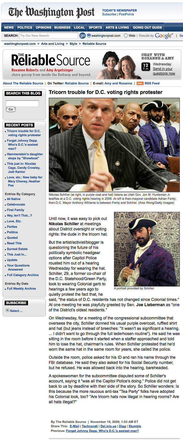
: rendered at 9,000 X 6,000 :

When the 2005 USGS aerial photography was released to the public in the spring of 2007 there were a few places that were censored through pixilation. On this blog I documented how the White House was censored. I documented how the U.S. Capitol was censored. And I even experimented with a QR-Code to show that the Washington Monument was censored. After doing some exploration within the newly obtained 2008 Washington, DC orthophotography, I discovered that the White House and the U.S. Capitol are STILL censored.
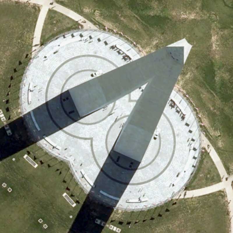
However, now that the construction of the new visitors center at the Washington Monument has been completed, which is the reason, I am told, why the Washington Monument was originally censored in the 2005 imagery, the imagery of the monument is now available without pixilation. Moreover, its the exact same imagery that is being used on Google Maps. While I expect to showcase the censorship of the White House & U.S. Capitol in some future entries, I decided to make make my first map of this new dataset of the Washington Monument because I wasn’t able to make it using the last batch of imagery.
To construct this map, I first rendered a full-size Hexagon Quilt Projection map using the original imagery, then sampled a portion of the resulting map, and used the sampled portion to create this derivative map. I chose to sample the portion in the first map because of two underlying aspects of the map. First, I really liked the way the shadows of the Washington Monument combined together. Secondly, I liked the way the apex of the Washington Monument was combined (see detail below) to create a pyramid. Over the years I have enjoyed playing with the notion of aerial & architectural chiaroscuro, as in, using shadows generated by buildings within the original aerial photography to create a new, larger shadow. This map embodies this ongoing design element perfectly.
View the Google Map of the Washington Monument on the National Mall in Washington, DC.
: detail :
View the rest of the details:
+ MORE