The Daily Render

by

A Digital Scrapbook for the Past, Present, and Future

| FRONT PAGE | GEOSPATIAL ART | DC HISTORY / TIMELINE | NEWS | COLONIST | FOUND MAPS | FRACTALS |
| PHOTOGRAPHY | ANTIQUE | DESIGN | VIDEO | | CONTACT |

Photo of my presentation at the New York Public Library
|| 10/5/2008 || 1:04 pm || Comments Off on Photo of my presentation at the New York Public Library || ||

Photograph by TaxiGang

The photograph above was taken yesterday by one of my friends in the audience.
The map on the projector screen is St. Paul Quilt.

A big thank you goes out to my friends who came to see the presentation!
You know who you are ;-)


You Street on YouTube || East Meets West || A Game of Locational Awareness
|| 8/5/2008 || 2:28 pm || 2 Comments Rendered || ||

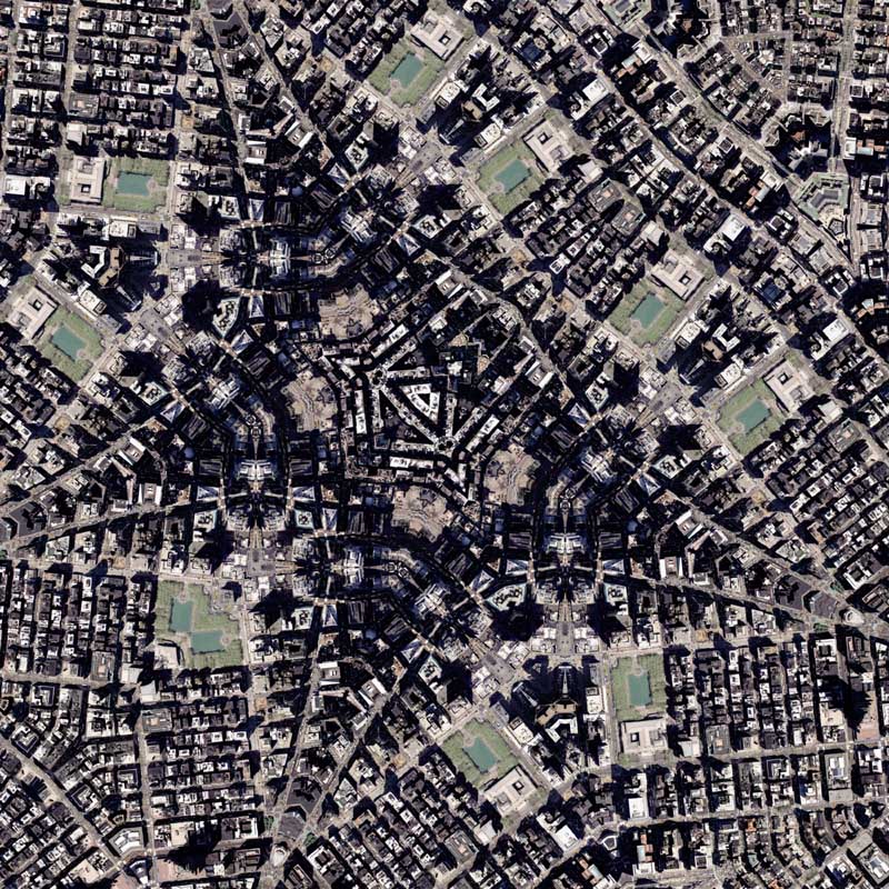
The other day after I watched the interview conducted on a bicycle the idea that had been swimming in the back of my head resurfaced. Originally it was going to be something simple, as in, one YouTube video for U Street (sometimes written out as You Street) in Washington, DC that featured me riding down the street at night and another video that would be filmed on the exact same stretch of road, but filmed during the day. By using the YouTube Doubler, the on-line mashup helper, the viewer would be able to simultaneously see the same stretch of road at two different times of the day.

After thinking about the concept more thoroughly, I literally went in a different direction (actually two) and came up with a game of sorts. Last Saturday I filmed myself riding on the same stretch of U Street going to one end of the street and then filmed myself going back to the same point where I started. I then edited the videos so they start where the other on ends and then I placed the two videos side-by-side using YouTube Doubler.

The object of the game is to find the exact location where the videos cross paths. As in, the video on the right features me riding my bike on U Street going due East and the video on the left features me riding my bike due West and somewhere in the videos there is a specific point where the two videos cross paths.

Since they were filmed at different times you won’t actually see me riding down the street, but there is an exact point on the street where the two videos intersect and its up to the viewer to figure out where East meets West or West meets East.

Since I had more traffic going West than I did going East, the West video is slightly longer, but the spot where the two videos cross paths does not change. It might take a couple tries, but eventually you’ll be able to figure out the spot in question. If you need help with a map or two, I created a special Google Map that shows the starting locations of the two videos.

I’ve already found the location, but do you think you can find it? If you do, leave the estimated time in the comment section!! The answer is quite easy.

Click the screen grab below to try it out:

One disappointment with this game is that YouTube’s compression still stinks. I uploaded the videos at 640×480 in size with minimal compression with the hopes that they’d show up less pixilated, but alas the option to view the videos in high-quality was not there when I checked last. I still don’t know why either. The unfortunate result is that you are unable to see as much detail in the videos, which means the game is slightly harder to “win.” Currently Vimeo does not have an autoplay option which makes this mashup impossible on their platform, so there really isn’t much I can do to fix the compression issue.

One idea is to remove the YouTube Doubler component and redesign the videos in Final Cut Pro. By adjusting the size of the final video, I can place both East & West into one video and release the game without compression. This will take me longer to complete, but I think it might be a worthy effort. Nonetheless, I hope you enjoy this game.


Related Interactive Entries:

+ MORE


This week is the four year anniversary of my geospatial art
|| 6/27/2008 || 5:27 pm || Comments Off on This week is the four year anniversary of my geospatial art || ||

Random geospatial art from somewhere on this website

This week marks the fourth year anniversary of when I started to publish my geographic designs on a this website. In the time since, which feels like only yesterday, I’ve published over 750 different creations on this website, which amounts to nearly 2,500 different image details. At first I started creating them partly as a quest for self-discovery and partly as a reaction to the fact that I was not able to graduate from college due financial circumstances. I wanted to document what I had learned, produced, researched, and published while on permanent sabbatical. After witnessing how my old housemate had to deal with on-line strangers on her now-defunct blog, I decided to do something that no other blogger had ever done before, I chose to keep the contents of my website hidden from web crawlers and subsequently, most strangers. This kept this website off the map of the internet for nearly 4 years. Only recently in March of this year, exactly one year after an internationally syndicated article was published about this website, did I open my website up to the dreaded robots. I don’t know where this year will lead me, but I’m glad I’ve made enough maps to point me in the right direction.

Check the aggregate listings: 2004, 2005, 2006, 2007, 2008.


New York Public Library Quilt
|| 6/25/2008 || 7:50 pm || Comments Off on New York Public Library Quilt || ||

: rendered at 18,000 X 12,000 :

This fractal octagon quilt projection map was recursively rendered four times before the final result above. It took approximately two hours for each rendering to complete and then each tessellation was sampled while maintaining the source spatial integrity. Altogether this map took about 12 hours of rendering time and post-processing time to complete. I intend on printing this out for the upcoming lecture.

View the Google Map of the area around the New York Public Library in New York City.

: detail :

View the rest of the details:

+ MORE


Exhibit Fly-Through in Reverse Slow-Motion @ Artomatic 2008
|| 5/12/2008 || 12:25 pm || Comments Off on Exhibit Fly-Through in Reverse Slow-Motion @ Artomatic 2008 || ||

Last night I took a 42 second fly-through of my Artomatic 2008 exhibit that I recorded on Friday afternoon and stretched & reversed the footage into a 3 minute and 30 second abstract animation. The video starts at the RECORD book, then pans & zooms into Freedom Plaza on Federal Triangle Quilt #4, pans across Nova et Accvratissima Totivs Terravm Oribis Tabvla [2008], zooms up close to Charlotte Spheres, and pans back over to Nova et Accvratissima Totivs Terravm Oribis Tabvla [2008] and ends.

Audio is from two tracks on disc one of Cold Krush Cuts by DJ Food & Coldcut (Ninja Tune 1997). It features a sermon I believe to be from Rev. Billy Graham about the Bug’s eye view versus the God’s eye view.

::::::::::Text of the sermon::::::::::

People who fly have a different view of the world than those who spend their lives on the ground. A very wise man once wrote a poem while he was flying, and he called this poem “The God’s Eye View,” and he said that this view was entirely different than the view he always had on the ground, which he called “The Bug’s Eye View.”

Out there, somewhere, in the air we fly through, exists an old Persian legend much like this poem about a bug who spent his entire life in the world’s most beautifully designed Persian rug. All the bug ever saw in his lifetime were his problems. They stood up all around him. He couldn’t see over the top of them, and he had to fight his way through these tufts of wool in the rug to find the crumbs that people had spilled on the rug. And the tragedy of the story of the bug in the rug was this: that he lived and he died in the world’s most beautifully designed rug, but he never once knew that he spent his life inside something which had a pattern. Even if he, this bug, had even once gotten above the rug so that he could have seen all of it, he would have discovered something – that the very things he called his problems were a part of the pattern.

Have you ever felt like that bug in the rug? That you are so surrounded by your problems that you can’t see any pattern to the world in which you live? Have you heard anybody say lately that the world is a total mess? That, my friends, is the Bug’s Eye View, and seeing only a little of the world, me might be inclined to think that this is true.

A better quality version of the video is viewable on Facebook.


+ MORE


The Base Map Installation @ Artomatic
|| 5/5/2008 || 1:15 pm || Comments Off on The Base Map Installation @ Artomatic || ||

About a month ago when I was planning out my Artomatic exhibit I came up with the idea to do a time-lapse video as a means to promote & showcase my upcoming exhibit. My friend Brian Liu made a similar styled video and I thought it would be fun to make one that shows both the location of the exhibit and teases viewers into seeing the actual exhibit.

The process involved in making the video was rather straightforward. Back in mid-April I went through my collection of printed maps and picked out a few that I didn’t care for. Then I went to my nearby CVS and purchased about 6 more DC, Maryland, and Virginia maps. I cleared out my dining room and laid out all the maps to see if they would cover the 12′ x 8′ space that I am alloted at Artomatic and once I realized that I had enough maps I began to cut them into roughly 1′ x 2′ sections. After that I went to the hardware store and purchased some wheatpaste and a paint brush. Finally, I contacted my friend Robin who’s done similar videos before and bounced the idea off of him. He thought it was a decent concept and after a few minor delays on Friday, April 25th, 2008 we went to the Artomatic space and recorded the entire installation from start to finish. About a week later I got the raw video from him, last night I edited it in Final Cut Pro, and today I uploaded it to YouTube.

I chose to use the tune “The Dub and the Restless” by Sonic Boom because it’s been a favorite of mine for ages and I felt it captured the essence of the time-lapse video quite well. I have contacted the musician and hopefully he’ll continue to let me use the video without issue.

Tomorrow I am going to the Artomatic space and will be doing some touch-up work to the wall because after my last visit to the site I noticed some of the map’s have become unstuck and I need to make sure they are securely fixed to the wall. Later this week I will be going to the space and putting up my maps over “the base map.” I’ll probably need to get some extra lighting in place and after that it should be ready for Friday’s opening! I have a couple other ideas for the exhibit, but they’ll be shared here when the time comes.

If you are in the Washington, DC area this Friday, please stop by and say hello!


Looks like someone from NOMA gave the Artomatic organizers one crappy raster graphic to use— notice the pixilation on their logo!

+ MORE


In today’s Washington Jewish Weekly newspaper
|| 2/28/2008 || 4:05 pm || Comments Off on In today’s Washington Jewish Weekly newspaper || ||

My piece at the JCC is mentioned in an article in today’s Washington Jewish Weekly:

The piece by D.C. resident Nikolas Schiller portrays the Palestinian refugees’ perspective and, he says, “dissent.” He is dissenting from the 1993 map of Israel and the Palestinian territories, upon which he based his kaleidoscope image, because he sees it as “biased” in showing the territories in stripes, he says.

He also has included an image of Handala, an iconic Palestinian cartoon that he found on the Internet, on the map. Handala, which means “bitterness” in Arabic, “represents the abused Palestinian refugees,” he says.

I don’t remember saying the word “abused” the entire time I spoke with the reporter, but I’ll let it slide.

Read the entire article:

+ MORE


Featured on-line with the Maps exhibition at the Walters Museum
|| 2/27/2008 || 7:17 am || Comments Off on Featured on-line with the Maps exhibition at the Walters Museum || ||

Screen grab showing a small detail of a Concentric Quilt

Starting in mid-November I’ve been volunteering my time with the Walters Museum‘s upcoming exhibition. They have a small technology center (4 iMacs) in their cafeteria which I was given the opportunity to review. I look forward to going to the opening later this month!!

The Walters Museum has also included a layer for Google Earth that I produced for the exhibit. You can download the layer here or here.


Mount Vernon Quilt #6
|| 11/7/2007 || 11:15 am || Comments Off on Mount Vernon Quilt #6 || ||

: rendered at 18,000 X 12,000 :
Mount Vernon Quilt #6

Using this portion of Mount Vernon Quilt #5, I created a derivative tessellation to create this fractal map.

This series of maps is one of my more unique endeavors. From #2 onwards, each was a created from a tessellated portion from the previous map. This recursive tessellation process created a more crystalline map with more lines of symmetry. The projection process was octagon, diamond, dodecagon, hexagon, octagon, and finally, a diamond.

The most important of all the maps was actually the first. From this map I was able to obtain my intended focal point of the mapping process, the Washington Monument of Baltimore. By tessellating that portion, I began the process of narrowing the scope of each subsequent tessellation to the area around the monument. What became clearly evident is the blue rooftop of the Peabody Institute and the unique geometry of the park. The hardest step in the tessellation process became finding the spot on the map that had the most monuments in it. The next time I do a series like this I am going have a set spot on the map that I will tessellate, as opposed to the current method which is a bit more random.

View the Google Map of the Mount Vernon neighborhood of Baltimore, Maryland

: detail :

View the rest of the details:

+ MORE


Mount Vernon Quilt #5
|| 11/4/2007 || 11:47 am || Comments Off on Mount Vernon Quilt #5 || ||

: rendered at 18,000 X 12,000 :
Mount Vernon Quilt #5

Using this portion of Mount Vernon Quilt #4, I created a derivative tessellation to create this fractal map.

Up next will be the final map of the Mount Vernon series.

View the Google Map of the Mount Vernon neighborhood of Baltimore, Maryland

View Details:

+ MORE


The Daily Render By
A Digital Scrapbook for the Past, Present, and Future.

©2004-2023 Nikolas R. Schiller - Colonist of the District of Columbia - Privacy Policy - Fair Use - RSS - Contact


::LAST 51 POSTS::

Fair Use


46 queries. 1.886 seconds.
Powered by WordPress

Photo by Charlie McCormick
Nikolas Schiller is a second-class American citizen living in America's last colony, Washington, DC. This blog is my on-line repository of what I have created or found on-line since May of 2004. If you have any questions or comments, please contact:

If you would like to use content found here, please consult my Fair Use page.

::THE QUILT PROJECTION::

Square
Square

Diamond
diamond

Hexagon
hexagon

Octagon
octagon

Dodecagon
Dodecagon

Beyond
beyond

::OTHER PROJECTIONS::

The Lenz Project
Lenz

Mandala Project
Mandala

The Star Series


Abstract Series
abstract

Memory Series
Memory

Mother Earth Series
Mother Earth

Misc Renderings
Misc

::POPULAR MAPS::

- The Los Angeles Interchanges Series
- The Lost Series
- Terra Fermi
- Antique Map Mashups
- Google StreetView I.E.D.
- LOLmaps
- The Inaugural Map
- The Shanghai Map
- Ball of Destruction
- The Lenz Project - Maps at the Library of Congress
- Winner of the Everywhere Man Award

::MONTHLY ARCHIVES::


::LOCATIONS & CATEGORIES::

  • 2004 Elections (2)
  • 2008 Elections (35)
  • 2014 Elections (4)
  • 2016 Elections (2)
  • ACLU (3)
  • Activism (287)
  • Adbusters (13)
  • Advertisements (33)
  • aerial photography (19)
  • Analysis (31)
  • Animals (30)
  • animated gif (7)
  • Animation (25)
  • Antique (104)
  • Apple (1)
  • Arabic (17)
  • Architectural Archeology (9)
  • Artomatic (25)
  • Astronomy (15)
  • Astrophotography (9)
  • Audio (2)
  • Awards (3)
  • Backpacking (2)
  • banner graphics (5)
  • Beat Google to the Map (56)
  • bicycle (23)
  • Birds-Eye View (5)
  • Blaeu (10)
  • Book Covers (7)
  • Bridge (10)
  • Building (15)
  • calendar (28)
  • calligraphy (6)
  • Capital (61)
  • Cars (18)
  • Cartography (74)
  • Cartoon (9)
  • Celestial (31)
  • Censorship (32)
  • Chinese (7)
  • Chronicling America (34)
  • Classroom (5)
  • Clothing (12)
  • Commentary (76)
  • Commissioned (27)
  • Credit Cards (3)
  • Crime (12)
  • Cyrillic Alphabet (1)
  • DAILY LINKS (30)
  • Dance (2)
  • DC History (93)
  • Design (102)
  • Digital Scrap (5)
  • Election (11)
  • ESA (3)
  • Facebook (19)
  • Fantasy (3)
  • Fashion (23)
  • Fast Food (2)
  • FBI (7)
  • Flag (15)
  • flickr (4)
  • Found Map (56)
  • French (9)
  • Gallery (54)
  • Gardening (25)
  • General (256)
  • George Bush (12)
  • GIS (69)
  • GMO Labeling (4)
  • Google (31)
  • Google AdSense (4)
  • Google AdWords (3)
  • Google Earth (28)
  • Google Maps (47)
  • Google Reader (4)
  • Google Streetview (8)
  • GPS (7)
  • Graffiti (5)
  • Greek (4)
  • Green (72)
  • Green Party (18)
  • Healthcare (15)
  • Highway (35)
  • Hiking (2)
  • Hipster (2)
  • history (151)
  • Holidays (10)
  • House Party (2)
  • Hubble Telescope (2)
  • Humor (88)
  • In The News (88)
  • Insects (2)
  • Interactive (74)
  • Interiors (4)
  • IP Trace (28)
  • Latin (22)
  • Law (15)
  • Lecture (11)
  • Legislation (19)
  • Library (21)
  • Library of Congress (66)
  • Location (1,018)
  • LOLMaps (3)
  • Mass Transit (6)
  • Memorandum (2)
  • meta-data (32)
  • Mobile Phone Applications (1)
  • Movie (3)
  • MrSID (4)
  • MSN (5)
  • Museum (5)
  • Music (48)
  • MySpace (6)
  • NASA (10)
  • National Archives (3)
  • News (182)
  • Obituary (2)
  • Oil (4)
  • Ornithology (4)
  • orthophotography (4)
  • OSCE (16)
  • Photography (134)
  • Poetry (18)
  • Portuguese (1)
  • postmodern (8)
  • QR code (9)
  • QTVR (4)
  • Radio (3)
  • Renderings (675)
  • RSS (3)
  • Seasons (12)
  • Sold (40)
  • Spanish (7)
  • Speech (5)
  • Sports (1)
  • Stadium (40)
  • statehood (94)
  • Statistics (2)
  • Stellarium (4)
  • Stereogram (1)
  • Street (21)
  • Street Art (10)
  • Submissions (5)
  • Tattoo (2)
  • Testimony (2)
  • time-lapse (19)
  • Torture (3)
  • Transportation (6)
  • TV (23)
  • Twitter (5)
  • University (41)
  • Update (24)
  • Vegetarianism (2)
  • Video (49)
  • Vimeo (18)
  • visualization (36)
  • Washington Critic (2)
  • Weather (19)
  • Web Crawler (9)
  • Wikipedia (14)
  • Wordpress (4)
  • Wordpress Upgrade (2)
  • World Wind (3)
  • Yahoo (6)
  • YouTube (113)
  • Zodiac (23)


  • thank you,
    come again!