The Daily Render

by

A Digital Scrapbook for the Past, Present, and Future

| FRONT PAGE | GEOSPATIAL ART | DC HISTORY / TIMELINE | NEWS | COLONIST | FOUND MAPS | FRACTALS |
| PHOTOGRAPHY | ANTIQUE | DESIGN | VIDEO | | CONTACT |

Nixon Sends GIs Into Cambodia And An Inverted 1970 Map of Communist Controlled Laos and Cambodia
|| 3/1/2009 || 8:53 pm || Comments Off on Nixon Sends GIs Into Cambodia And An Inverted 1970 Map of Communist Controlled Laos and Cambodia || ||

The other week I found this flyer in the Library of Congress’ An American Time Capsule: Three Centuries of Broadsides and Other Printed Ephemera. I inverted the colors because the location of the conflict & reason for mobilization are different, but the circumstances remain timely because America currently at war in two countries. I remember going to the White House for a demonstration nearly six years ago the weekend after George Bush invaded Iraq. I have the video that I produced that day somewhere backed up and I plan on uploading to the YouTube this month as a somber reminder. However, I learned six years ago that our government is going to go to war without the consent of the American public and protesting, while important, does little to change the course of events in present-day America. 39 years ago, however, demonstrations were an important part of ending the war in Vietnam. But will they help bring the troops home from Iraq & Afghanistan? Doubtful. Really doubtful.


THE WASHINGTON POST – Friday, May 1, 1970

Nixon Sends GIs Into Cambodia

NIXON DECLARES ALL-OUT WAR ON SOUTHEAST ASIA

THE PEOPLE MUST ACT NOW

MASS MEETING at the WHITE HOUSE at noon on saturday, may 9

In another attempt to stifle dissent, the Nixon administration has handed down regulations prohibiting demonstrations on federal park land without a 15 day advance notice. Public outrage at the invasion of Cambodia is so great we will go to the White House in spite of these regulations. We will assert our right to peacefully assemble. The police may block us. If they also decide to arrest us, we will maintain a militant non-violent discipline, and options will be provided for those not prepared for arrest. Meet us at the White House!

DEMAND IMMEDIATE WITHDRAWAL OF ALL U.S. TROOPS & SUPPLIES FROM SOUTHEAST ASIA

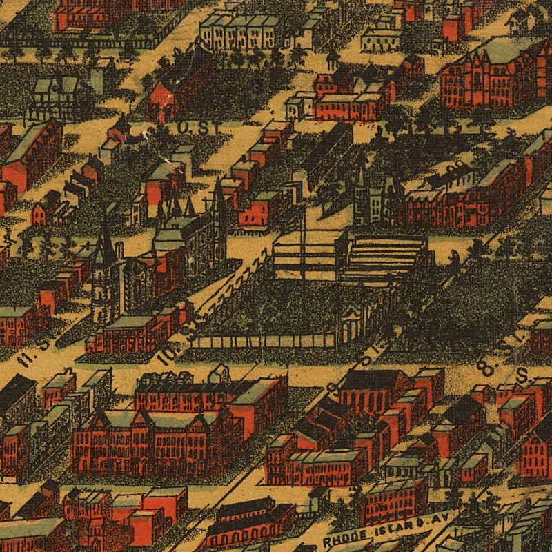
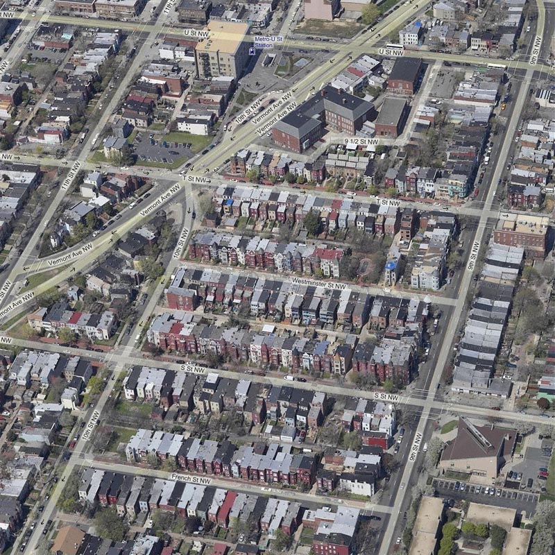
The New Mobilization Committee to End the War in Vietnam — 1029 Vermont Av. N.W. Wash. D.C. 20005


Courtesy of the Library of Congress


Notes:
1) On the transcription page on the Library of Congress website, I found that the map above was improperly cited as an “illustration”
2) I believe the map was probably published in the Washington Post on Friday May 1st, 1970


Related Antique Entries:

+ MORE


An Act for establishing the Temporary and Permanent seat of the Government of the United States
|| 2/24/2009 || 12:35 pm || Comments Off on An Act for establishing the Temporary and Permanent seat of the Government of the United States || ||

For last month or so I’ve been adding historic pieces of legislation here on my blog. The aim here, and the general aim of this blog, is to keep an ongoing, on-line journal that features things that I’m either interested in or things that I have created. Historic pieces of legislation related to the District of Columbia fall into the former category, and today’s entry is the text & scans of the act that established the Temporary (Philadelphia) and Permanent Seat of the Government of the United States in a “district of territory” that would eventually become named the District of Columbia.


+ MORE


Text of the District of Columbia Organic Act of 1871
|| 1/30/2009 || 5:23 pm || Comments Off on Text of the District of Columbia Organic Act of 1871 || ||

The District of Columbia Organic Act of 1871 aka “An Act to provide a Government for the District of Columbia (41st Congress, 3d Sess., ch. 62, 16 Stat. 419, enacted 1871-02-21) is an Act of Congress, which revoked the individual charters of the City of Washington, the City of Georgetown, and the County of Washington and created a new city government for the entire District of Columbia. The legislation effectively merged what had been separate municipalities within the federal territory into a single entity. It is for this reason that the city, while legally named the District of Columbia, is still commonly known as Washington, D.C. However, this act was abolished in 1874, and while the name did not change, the territorial Governor was replaced with a three-member Board of Commissioners appointed by the President. This system existed until 1974 when the District of Columbia Home Rule Act allowed for District residents to elect their own mayor.

Below is the text of the bill:

Continue reading the bill:

+ MORE


Text of the District of Columbia Organic Act of 1801
|| 1/29/2009 || 5:12 pm || Comments Off on Text of the District of Columbia Organic Act of 1801 || ||

The District of Columbia Organic Act of 1801 (officially An Act Concerning the District of Columbia) (6th Congress, 2nd Sess., ch. 15, 2 Stat. 103, enacted 1801-02-27) is an Act of Congress, which incorporated the District of Columbia and divided the territory into two counties: Washington County to the east of the Potomac River and Alexandria County to the west. The charters of the independent cities of Georgetown and Alexandria were left in place and no change was made to their status. The laws of both Maryland and Virginia continued to remain in force within the District.

Below is the text of the bill:

Continue reading the bill:

+ MORE


Tabvla Temporis [Semidiurni in fignis Borealibus / Australibus]
|| 5/25/2008 || 12:17 am || Comments Off on Tabvla Temporis [Semidiurni in fignis Borealibus / Australibus] || ||

This is the reverse side of Willem Janszoon Blaeu’s Nova totius terrarum orbis geographica ac hydrographica tabula (Amsterdam 1606) which I used in my recent creation A New & Arabesque Map of the Hirshhorn Museum. If you look closely, you can see the reverse of original map that bled through the paper after couple hundred years and some image manipulation. The table shown is similar to an Ephemeris, which is table of values that gives the positions of astronomical objects in the sky at a given time. I would love for someone to sit and explain the way one goes about reading these types of antique charts. I understand a fair amount of what is being shown, but I do not fully grasp how to apply the calculations.


Then & Now Birds-Eye Views of the Westminster Neighborhood in Washington, DC [1884 & 2005]
|| 4/14/2008 || 12:42 pm || Comments Off on Then & Now Birds-Eye Views of the Westminster Neighborhood in Washington, DC [1884 & 2005] || ||

Detail the bicycle track before Westminster Street was created
from Adolph Sachse’s birds-eye view of the nation’s capital, 1884

Due to file format issues, only recently have I been able to open most of the maps available in the Library of Congress’ American Memory Collection. Last night I found an interesting birds-eye view map of Washington, DC by Adolph Sachse that was published in 1884. Its a massive map that appears to be composed of six separate sheets and contains a listing of many of the businesses in Washington City as well as locations of various public & government buildings. In many ways the map acts like a geovisual address book (the phone had not been invented yet) because, at a glance, one can easily find services offered by local merchants. Judging by the branding in the upper right hand corner of the original map, it appears that the map was sponsored by the Baltimore & Ohio Railroad Company, a major railroad company of the day.

According to my neighborhood’s official history, Westminster Street did not exist in 1884 and the birds-eye view above supports this claim. While not labeled in the image above, Parcel 362, as it was known on the original DC maps, was called also called “the old circus ground” and Athletic Park. It had a 150-foot long grand stand along T Street, which was built in 1883 (building permit number 1047) in preparation for the fifth national convention of the League of American Wheelmen, a national organization of bicyclists. The first American bicyclist to ever ride 100 miles on an outdoor track did it on that track in 1884. As someone who uses a bicycle as their primary means of urban transportation, I can only smile knowing that 121 years ago my residence was an outdoor bicycle race track. However, I laugh because I traveled with an exgirlfriend’s family circus when I was younger!

Below is a birds-eye view of the Westminster Neighborhood published by Microsoft, with imagery of Pictometry International. It features imagery that was taken in 2005 and when compared, you can see how much the area has changed in the last 121 years. The Athetic Park is gone and in it’s place are dozens of rowhouses that were built shortly after the map above was published. A unique and historically aware addition to the neighborhood is something you can see below in the playground on Westminster Street. No, it’s not because that is where I had my exhibit “North, South, East, Westminster“. Rather, if you look closely, you can see a small race track! A scaled reminder of what once was.

Detail of the Westminster Neighborhood by Microsoft, with imagery of Pictometry International


Related Bicycle Entries:

+ MORE


Within Sight of the White House [Overlay of Hooker’s Division]
|| 12/9/2007 || 2:30 am || 1 Comment Rendered || ||

[image links to .kmz file]
Google Earth Screen Shot of the Antique Overlay

One of the maps I recently downloaded was from a newspaper clipping showing the area near the White House. With 50 Saloons and 109 Bawdy-Houses the map was drawn to highlight business owners who were paying Federal taxes but not DC taxes. Of importance is how nearly all but four of the business owners were female. Were they not paying taxes because they were disenfranchised? Women’s suffrage didn’t come for another 30 years with the passage of the 19th Amendment. By taking the map and importing it into Google Earth, I was able to arrange it so that the buildings line up with minimal distortion. It’s not a perfect map, but it is truly an interesting glimpse into downtown Washington, DC in the 1890’s.

Today most of the buildings are all gone. There are some exceptions, like City Hall (Central Powerhouse) and the Old Post Office, which is written as the “New Post Office” on the map. In the place of the 109 Bawdy-Houses and 50 Saloons was the creation of Federal Triangle. Ohio Ave- gone, DC’s entertainment center, gone as well. Later built, on the year of my birth, was Freedom Plaza which was designed to look like L’Enfant’s map no less. By adjusting the antique map’s transparency you can see a approximately 117 years of development. From brothel to federal, what a strange entity time is.

Transcription:

+ MORE


(Mecca) is now Makkah
|| 11/28/2007 || 10:27 pm || Comments Off on (Mecca) is now Makkah || ||

On August 12th, 2007 I took this screenshot for my blog entry related to the Astro-theological overlays for Google Earth. The project overlaid the zodiac on locations of religious importance: Vatican City, Mecca, and Jerusalem.

Today I discovered that that the names for the locations have changed in Google Earth.

note: the Kaaba is in the lower right-hand corner

My entire life I have always spelled it the city as Mecca. I wonder when this was changed? Should I change my spellings? Some day I would like to visit the holy city of Makkah :-)


Related Mecca Entries:

+ MORE


The Astro-Theological Overlays for Google Earth
|| 8/12/2007 || 12:14 pm || Comments Off on The Astro-Theological Overlays for Google Earth || ||

Click on the image below to download the .kmz file [888 Kb] for Google Earth:

Instead of just wrapping the Astrological Calendar from 1544 around the earth, today I decided to place the calendar alongside the 3 holy locations of Catholicism, Christianity, Islam, and Judaism. This geographic juxtaposition of pagan symbolism with established religion makes this series of overlays one of the more interesting cartographic creations I’ve ever made.

Continue reading:

+ MORE


An Updated Astrological Calendar from 1544 – Eastern Hemisphere
|| 8/10/2007 || 10:31 pm || Comments Off on An Updated Astrological Calendar from 1544 – Eastern Hemisphere || ||

About a month ago I made the first version of the map using the Western Hemisphere. At the time I didn’t even think about making a secondary map for the Eastern Hemisphere.

Continue reading:

+ MORE


The Daily Render By
A Digital Scrapbook for the Past, Present, and Future.

©2004-2023 Nikolas R. Schiller - Colonist of the District of Columbia - Privacy Policy - Fair Use - RSS - Contact


::LAST 51 POSTS::

Fair Use


52 queries. 0.879 seconds.
Powered by WordPress

Photo by Charlie McCormick
Nikolas Schiller is a second-class American citizen living in America's last colony, Washington, DC. This blog is my on-line repository of what I have created or found on-line since May of 2004. If you have any questions or comments, please contact:

If you would like to use content found here, please consult my Fair Use page.

::THE QUILT PROJECTION::

Square
Square

Diamond
diamond

Hexagon
hexagon

Octagon
octagon

Dodecagon
Dodecagon

Beyond
beyond

::OTHER PROJECTIONS::

The Lenz Project
Lenz

Mandala Project
Mandala

The Star Series


Abstract Series
abstract

Memory Series
Memory

Mother Earth Series
Mother Earth

Misc Renderings
Misc

::POPULAR MAPS::

- The Los Angeles Interchanges Series
- The Lost Series
- Terra Fermi
- Antique Map Mashups
- Google StreetView I.E.D.
- LOLmaps
- The Inaugural Map
- The Shanghai Map
- Ball of Destruction
- The Lenz Project - Maps at the Library of Congress
- Winner of the Everywhere Man Award

::MONTHLY ARCHIVES::


::LOCATIONS & CATEGORIES::

  • 2004 Elections (2)
  • 2008 Elections (35)
  • 2014 Elections (4)
  • 2016 Elections (2)
  • ACLU (3)
  • Activism (287)
  • Adbusters (13)
  • Advertisements (33)
  • aerial photography (19)
  • Analysis (31)
  • Animals (30)
  • animated gif (7)
  • Animation (25)
  • Antique (104)
  • Apple (1)
  • Arabic (17)
  • Architectural Archeology (9)
  • Artomatic (25)
  • Astronomy (15)
  • Astrophotography (9)
  • Audio (2)
  • Awards (3)
  • Backpacking (2)
  • banner graphics (5)
  • Beat Google to the Map (56)
  • bicycle (23)
  • Birds-Eye View (5)
  • Blaeu (10)
  • Book Covers (7)
  • Bridge (10)
  • Building (15)
  • calendar (28)
  • calligraphy (6)
  • Capital (61)
  • Cars (18)
  • Cartography (74)
  • Cartoon (9)
  • Celestial (31)
  • Censorship (32)
  • Chinese (7)
  • Chronicling America (34)
  • Classroom (5)
  • Clothing (12)
  • Commentary (76)
  • Commissioned (27)
  • Credit Cards (3)
  • Crime (12)
  • Cyrillic Alphabet (1)
  • DAILY LINKS (30)
  • Dance (2)
  • DC History (93)
  • Design (102)
  • Digital Scrap (5)
  • Election (11)
  • ESA (3)
  • Facebook (19)
  • Fantasy (3)
  • Fashion (23)
  • Fast Food (2)
  • FBI (7)
  • Flag (15)
  • flickr (4)
  • Found Map (56)
  • French (9)
  • Gallery (54)
  • Gardening (25)
  • General (256)
  • George Bush (12)
  • GIS (69)
  • GMO Labeling (4)
  • Google (31)
  • Google AdSense (4)
  • Google AdWords (3)
  • Google Earth (28)
  • Google Maps (47)
  • Google Reader (4)
  • Google Streetview (8)
  • GPS (7)
  • Graffiti (5)
  • Greek (4)
  • Green (72)
  • Green Party (18)
  • Healthcare (15)
  • Highway (35)
  • Hiking (2)
  • Hipster (2)
  • history (151)
  • Holidays (10)
  • House Party (2)
  • Hubble Telescope (2)
  • Humor (88)
  • In The News (88)
  • Insects (2)
  • Interactive (74)
  • Interiors (4)
  • IP Trace (28)
  • Latin (22)
  • Law (15)
  • Lecture (11)
  • Legislation (19)
  • Library (21)
  • Library of Congress (66)
  • Location (1,018)
  • LOLMaps (3)
  • Mass Transit (6)
  • Memorandum (2)
  • meta-data (32)
  • Mobile Phone Applications (1)
  • Movie (3)
  • MrSID (4)
  • MSN (5)
  • Museum (5)
  • Music (48)
  • MySpace (6)
  • NASA (10)
  • National Archives (3)
  • News (182)
  • Obituary (2)
  • Oil (4)
  • Ornithology (4)
  • orthophotography (4)
  • OSCE (16)
  • Photography (134)
  • Poetry (18)
  • Portuguese (1)
  • postmodern (8)
  • QR code (9)
  • QTVR (4)
  • Radio (3)
  • Renderings (675)
  • RSS (3)
  • Seasons (12)
  • Sold (40)
  • Spanish (7)
  • Speech (5)
  • Sports (1)
  • Stadium (40)
  • statehood (94)
  • Statistics (2)
  • Stellarium (4)
  • Stereogram (1)
  • Street (21)
  • Street Art (10)
  • Submissions (5)
  • Tattoo (2)
  • Testimony (2)
  • time-lapse (19)
  • Torture (3)
  • Transportation (6)
  • TV (23)
  • Twitter (5)
  • University (41)
  • Update (24)
  • Vegetarianism (2)
  • Video (49)
  • Vimeo (18)
  • visualization (36)
  • Washington Critic (2)
  • Weather (19)
  • Web Crawler (9)
  • Wikipedia (14)
  • Wordpress (4)
  • Wordpress Upgrade (2)
  • World Wind (3)
  • Yahoo (6)
  • YouTube (113)
  • Zodiac (23)


  • thank you,
    come again!