The Daily Render

by

A Digital Scrapbook for the Past, Present, and Future

| FRONT PAGE | GEOSPATIAL ART | DC HISTORY / TIMELINE | NEWS | COLONIST | FOUND MAPS | FRACTALS |
| PHOTOGRAPHY | ANTIQUE | DESIGN | VIDEO | | CONTACT |

A New & Somewhat Accurate Map of the Tropic of Gemini and the Tropic of Sagittarius
|| 9/4/2008 || 7:11 pm || Comments Off on A New & Somewhat Accurate Map of the Tropic of Gemini and the Tropic of Sagittarius || ||


For the last month I’ve been working on a slightly strange map above. It’s based on Johannes van Loon’s “Scenographia systematis mvndani Ptolemaici” (1660), which includes an “Axis Zodiaci” that shows the signs of Gemini and Sagittarius being slightly more illuminated than Cancer & Capricorn (see below). This shading possibly indicates that the author was aware of natural movement of the earth since the time of Ptolemy (~125 A.D.).

A new & somewhat accurate map of the Tropic of Sagittarius and the Tropic of Gemini was created using two maps of the Tropics from Wikipedia. I added the glyphs of the Zodiac over the meridians, but unlike the antique map below, I moved the signs backwards. The word “tropic” itself comes from the Greek tropos, meaning turn, referring to the fact that the sun appears to “turn back” at the solstices. I have read that in 1989 the Tropic of Gemini moved into the constellation of Taurus, which technically means it should be the “Tropic of Taurus,” but to keep the circle of animals in exact opposition, I kept the tropic in Gemini, hence “somewhat accurate.”

Close-up detail of A New & Somewhat Accurate Map of the Tropic of Gemini and the Tropic of Sagittarius

For hundreds of years cartographers have included the Tropic of Capricorn and the Tropic of Cancer on nearly all globes and world maps. Yet with the natural movement of the earth through space & time, the solstices are not located in the constellations of Capricorn or Cancer anymore. So why do cartographers continue to label the maps & globes using this incorrect information? Does cartographic tradition trump astronomical observation? Should contemporary maps be changed to reflect the passage of time? Are there any antique maps that place the Tropics in any other constellations? Leave your comments below.

Johannes van Loon’s “Scenographia systematis mvndani Ptolemaici” (1660)


Postscript: I believe I was incorrect in my analysis above. I failed to take into account the sideral.


Related Antique Entries:

+ MORE


My map of the Pentagon to be featured in the “We Are Here” Map Archive in the touring exhibition “Experimental Geography” [2008-2010]
|| 8/15/2008 || 1:39 pm || Comments Off on My map of the Pentagon to be featured in the “We Are Here” Map Archive in the touring exhibition “Experimental Geography” [2008-2010] || ||

I was contacted by Daniel Tucker in January of this year to participate in his map archive. I thought it was a great idea so I offered my Pentagon Quilt #3 map. I received notification this week that the map archive starts its tour for the next two years with the exhibit called Experimental Geography. Here’s the blurb from the website:

EXPERIMENTAL GEOGRAPHY
Geography benefits from the study of specific histories, sites, and memories. Every estuary, land fill, and cul-de-sac has a story to tell. The task of the geographer is to alert us to what is directly in front of us, while the task of the experimental geographer, an amalgam of scientist, artist, and explorer, is to do so in a manner that deploys aesthetics, ambiguity, poetry, and a dash of empiricism. This exhibition explores the distinctions between geographical study and artistic experience of the earth, as well as the juncture where the two realms collide (and possibly make a new field altogether).

The manifestations of “experimental geography” (a term coined by geographer Trevor Paglen in 2002) run the gamut of contemporary art practice today: sewn cloth cities that spill out of suitcases, bus tours through water-treatment centers, performers climbing up the sides of buildings, and sound works capturing the buzz of electric waves on the power grid. In the hands of contemporary artists, the study of humanity’s engagement with the earth’s surface becomes a riddle best solved in experimental fashion. The exhibition presents a panoptic view of this new practice, through a wide range of mediums including interactive computer kiosks, sound and video installations, photography, sculpture, and experimental cartography.

The approaches used by the artists featured in Experimental Geography range from a poetic conflation of humanity and the earth to more empirical studies of our planet. For example, Ilana Halperin explores the intersection of personal, historic, and geologic time, as may be seen in the photograph of her stooping at the edge of natural hot springs to boil a small cup of milk. Creating projects that are more empirically minded, the Center for Land Use Interpretation (CLUI), a research organization, examines the nature and extent of human interaction with the earth’s surface, embracing a multidisciplinary approach to fulfilling its mission. Using pragmatic skill sets culled from the toolbox of geography, CLUI forces a reading of the American landscape (which includes traffic in Los Angeles, submerged cities, and the broadcast towers in the San Gabriel Mountains) that refamiliarizes the viewer with the overlooked details of their everyday experience.

Experimental Geography is curated by Nato Thompson, curator and producer at Creative Time in New York, and is accompanied by an illustrated catalogue.

Featuring:
Francis Al
AREA Chicago
The Center for Land Use Interpretation (CLUI)
the Center for Urban Pedagogy (CUP)
kanarinka (Catherine D’lgnazio)
e-Xplo
Ilana Halperin
Lize Mogel
Multiplicity
Trevor Paglen
Raqs Media Collective
Ellen Rothenberg
Julia Meltzer and David Thorne
Spurse
Deborah Stratman
Daniel Tucker, Organizer, The We are Here Map Archive < --- Hi! Alex Villar
Yin Xiuzhen

Featured in Daniel Tucker’s We are Here Map Archive:

1. Bill Rankin “My cities” 1978-2004
2. Bill Rankin “The United States” 2003-2007
3. Counter Cartography Collective “Disorientation Guide” 2006
4. Nikolas R. Schiller “Pentagon Quilt #3” 2007
5. Ashley Hunt “Prison Map” 2003
6. Friends of William Blake “The People’s Guide to the RNC” 2004
7. Subrosa “Biopower Unlimited” 2002
8. Ecotrust Canada “Statement of Intent Boundaries” 2008
9. NYC Indypendent “Threat to Peace”
10. Repohistory “Circulation” 2000
11. Lize Mogel and Dario Azzellini “The Privatization of War: Colombia as Laboratory and Iraq as Large-Scale Application” 2007/2008
12. Beehive Design Collective “FTAA” 2003
13. Jeffrey Warren “Armsflow” 2006
14. Center for Urban Pedagogy “Cargo Chain” 2008
15. Temporary Travel Office “Contaminating the Preserve” 2008
16. Hackitectura (Pablo de Soto, Jose Perez de Lama osfa, Marta Paz sweena), Indymedia Estrecho and collaborators “Tactical Cartography of the Straits” 2004
17. Ayreen Anastas and Rene Gabri “Fear is Somehow Our For Whom? For What? and Proximity to Everything Far Away” 2006
18. The Los Angeles Urban Rangers “Malibu Public Beaches” 2007
19. The Los Angeles Urban Rangers “Los Angeles Urban Rangers Official Map and Guide” 2004
20. The Los Angeles Urban Rangers “LA County Fair” 2006
21. The Institute for Infinitely Small Things “City Formerly Known As Cambridge”
22. Amy Franceschini “Silicon Valley Superfund Sites” 2006
23. Amy Franceschini “Intentional Communities in Silicon Valley” 2008
24. Adriane Colburn “Whose On Top (race to the pole, part two)” 2008
25. Bureau d’études “World Government” 2005
26. Grupo de Arte Callejero “Aqui Viven Genocidas”

There will be a catalog for the exhibition that will be published by Melville House Books. I look forward to getting a copy when it comes out.

The tour starts next month and has dates that are still available. I would like for it to come to Washington, DC! :-)

Exhibition Itinerary

Richard E. Peeler Art Center , DePauw University, Greencastle, Indiana
September 19 – December 2, 2008

Rochester Art Center, Rochester, Minnesota
February 7 – April 18, 2009

The Albuquerque Museum, Albuquerque, New Mexico
June 28 – September 20, 2009

AVAILABLE
October 2009 – January 2010

Colby College Museum of Art, Waterville, Maine
February 21 – May 30, 2010

AVAILABLE
June – August 2010

Click on the detail of Pentagon Quilt #3 below to view the rest of the map:

Related Virginia Entries:

+ MORE


Tabvla Festorvm – Table of important Catholic dates from Opera Mathematica
|| 8/13/2008 || 6:32 pm || Comments Off on Tabvla Festorvm – Table of important Catholic dates from Opera Mathematica || ||

Page 394 in the Fifth Volume of Chrisopher Clavius’s Opera Mathematica (1612)
Courtesy of the Mathematics Library at the University of Notre Dame

One of the chief architects of the Gregorian Calendar was Jesuit mathematician & astronomer Chrisopher Clavius. In his “Romani calendarii a Gregorio XIII restituti explicatio” (Rome, 1603) he explained the process behind the creation of the Gregorian Calendar. The table above shows the contemporary dates of the Pentecost, Septuagesima, the Paschal Full Moon as well as some other calculations that are hardly used today. Shortly after his death in 1612, this explanation was republished in volume five of Opera Mathematica.

This volume, known as the explanation of the Gregorian Calendar, literally features hundreds upon hundreds of charts like the one above that show the Roman Calendar going thousands of years into the future. Seriously, its truly amazing how far into the future his tables go! If I had some more time to dabble around with his calculations, it would be neat to see how far they are off after nearly 400 years.


Related Calendar Entries:

+ MORE


Gregorius XIII – Pont(ifex) Opt(imus) Maximus / Anno Restituto MDLXXXII
|| 8/12/2008 || 2:27 pm || Comments Off on Gregorius XIII – Pont(ifex) Opt(imus) Maximus / Anno Restituto MDLXXXII || ||

“Pope Gregory XIII / Year of Restitution 1582”
Minted in 1582 to celebrate the creation of the new Roman calendar,
which later became known as the Gregorian Calendar

The other day I was reading about the Gregorian Calendar and stumbled across this coin that was created the year of the calendar reform. It features a portrait of Pope Gregory XIII on the front, and on the back this is dragon eating it’s tail surrounding a ram’s head. The dragon is called an Ouroboros, which I named my recent time lapse video, and as I mentioned before, it represents the cyclicality of time surrounded by the Egyptian Sun God Amun, who’s name means “the one who is hidden.” I find this symbology very interesting because what we consider today to be pagan symbols were used to mark the creation of their perfect calendar— the calendar we use today.

In my opinion, the Ouroboros represents the Milky Way and the Ram represents the sun, and by creating a perfect calendar the sun & the cosmos were finally set in perfect harmony. Except one thing, and in my opinion, the most important part of it all, the perfect calendar removes the importance of natural precession. As in, as the dragon devours its tail, it slowly moves in a circle, and that circle represents the earth’s slow precession backwards through the zodiac. By keeping the months standardized, the natural movement of the Earth is not accounted for in our modern calendar because the Gregorian Calendar standardized the timing of the Paschal Full Moon so all Christians could celebrate Easter on the same day. With that sense of natural drift removed, the understanding behind the Earth’s natural movement around the sun and the origins of why ancients used the Zodiac was diminished.

A good example of this natural drift is the removal of 10 days from October in 1582. Part of this was due to the Julian calendar‘s natural error, but in my opinion, a partial correction in regards to natural drift. In the last 426 years at an average drift of 1 degree every 71.6 years, the earth has precessed approximately 6 degrees since the calendar’s creation. If each sign in the Zodiac is 30 Degrees, then the earth has moved 1/5 of its way through the age since the calendar’s creaction. Interesting stuff! What’s really funny is what I posted here exactly one year ago today.


Related Calendar Entries:

+ MORE


The Vicissitude of the Seasons Explained
|| 8/7/2008 || 1:59 pm || Comments Off on The Vicissitude of the Seasons Explained || ||

The other day I posted the Analemma featured on Bowles 1780 Map of the World. Today I am posting another ancillary chart from the map that I thought was interesting. It is called the Vicissitude of the Seasons and it explains the nature of the seasons in a given year. Vicissitude means “a state of being changeable or in flux; the rise and decline of a phenomenon,” and the transcribed chart below is the explains how the Earth slowly goes from Summer to Spring. I’ve been thinking a lot about the seasons lately and I have been working on a new map to address their change over time.

In this Diagram S represent the Sun, A XII BXII the Earth as moving round the Sun in the plane of the Ecliptic, according to the Order of the Signs Aries, Taurus, Gemini, etc. P is the North Pole, C the Arctic Circle, T the Tropic of Cancer, E the Equator, AXIIB the enlightened half of the Earth, where it is Day. BXIIA the darkened half where it is Night and BCA is the boundary of light & darkness. The Earth’s position with respect to the Sun is here shewn at the beginning of Ecliptic and here tis plain that the Earth moves through the Signs Libra, Scorpio, Sagittarius, Capricornus, Aquarius, and Pisces (which is from the 21st of March till the 23 of September) the North Pole P is constantly enlightened, and the Northern Places have their days longer than their Nights. But as the Earth proceeds through Aries, Taurus, Gemini, Cancer, Leo, and Virgo (which is from the 23rd of September till the 21st of March, the North Pole is constantly in the Dark and the Northern places have their Nights longer their Days.

Thus, supposing the Circle, L to be parallel of Latitude of London, we perceive that a greater part of it is in the Light than in the Dark from the 21st of March to the 23rd of September and the contrary from the 23rd of September till the 21st of March. On these two days it is just half in the light and half in the dark which shews the Days and Nights to be equally long. On the 21st of June it is most of all in the light, which shews that its days are then at the longest and on the 21st of December it is least of all in the light which shews its days are then at the shortest. The like to be understood of any other place situated in the Northern Hemisphere whilst the reverse happens to those in the Southern. But at each Pole there is only one Day and one Night in the whole Year. N.B. In whatever part of the Ecliptic the Earth is in, as seen from the Sun, the Sun is then the opposite part thereof as seen from the Earth.


I think I might use the graphic on the cover of next year’s calendars. Its very similar to the zodiac in Battista Agnese‘s Portolan atlas from 1544 that I used on last year’s calendars.


Related Zodiac Entries:

+ MORE


The Use of the Analemma – As explained around 1780
|| 8/1/2008 || 4:54 pm || Comments Off on The Use of the Analemma – As explained around 1780 || ||

A couple months ago I posted the astrophotography of Anthony Ayiomamitis and went into some cursory detail in explaining what an Analemma was. Last night I was perusing the on-line collection of maps in the Library of CongressGeography & Mapping Division and came across Bowles’s new and accurate map of the world, or Terrestrial globe : laid down from the best observations and newest discoveries particularly those lately made in the south seas by Anson, Byron, Wallis, Bouganville, Cook, and other celebrated circumnavigators, illustrated with a variety of useful projections and representations of the heavenly bodies the most approved astronomical and geographical definitions tables, and problems with an easy and familiar explanation of the most curious and interesting phoenomena in the universal system. (yeah thats the official name of the map!)

It was published around 1780 in London for the proprietor Carington Bowles and it features quite a few ancillary maps, including a map of the solar system- both northern & southern hemisphere, astronomical latitude and longitude analemma (below), a chart of the world drawn according to Mercator’s projection, a map of the moon (a selenograph), and a diagram of seasons (which I absolutely love). I expect to reuse portions of this map for upcoming entries because its so laden with unique information. For example, there are drawings on how the planets looked like through the telescope and even the oldest drawings of sunspots that I’ve ever seen.

As for this entry, on the right side of the map are two spheres that were designed to teach the viewer how to understand the Analemma and use it to estimate the location of the Sun, planet, or any fixed star anytime in the past, present, or future. While I still haven’t fully wrapped my mind around the instructions, I have transcribed the text from the map below. There are a few errors and typos but I tried my best to keep the text as close to the original as possible.

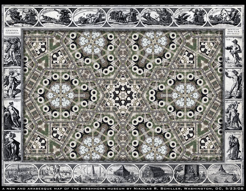
By clicking on either of the images you can view a larger version and investigate the text yourself. As a decorative element, I used a portion of the tessellation I used to construct Meridian Hill Park Quilt #4 as the background.

The Use of the Analemma
The Analemma is a very useful (tho’ not commonly used) Projection of the Sphere on a plane. In this Projection the Eye is supposed to view the Sphere or Globe with all its Lines both real and imaginary from a Place so far distant that Mathematicians usually term this Distance in definite, and sometimes infinite.

In this Projection the Meridians and Circles of Declination as they are farther removed from the Centre of the Projection, appear nearer to each other and therefore more confused and on this Account Maps of the Earth and Heavens are generally delineated according to other Principles. Nevertheless there are several Properties belonging to this orthographic Projection, which are superior to all other Projections namely. 1st. In this Projection, the Circles of Latitude on the Earth’s Globe, from the Equator to the Pole, are all of them strait Lines, as are also all those Circles of equal Distance from London or any other Place on the Earth’s Globe all around London or any other Place. 2nd. The Distances of Places in the same Latitude are also measured by strait Lines in this Projection 3rd. The Meridians are Ellipses in this Projection and the Degrees of terrestrial Latitude are here measured on those Ellipses.

In like Manner for the Heavens 1st. The Parallels of the Sun’s and Stars Declination from the Equator, are in this Projection measured by strait Lines, which affords a very easy and elegant Construction of Properties of the celestial Sphere on a Plane. 2nd. The Parallels of Altitude for Sun or Stars at any Place on the Earth’s Globe are here also Strait Lines, Like the Parallels of Declination. 3rd. The Celestial Meridians, and the great Circles extending from the Zenith to the Nadir, in this Projection are Ellipses. 4th The Sun’s Declination North or South being but 23 1/2 degrees and the Degrees being in this Projection so near to an Equality from the Centre to the Tropic of Cancer and the Tropic of Capricorn, several of the most entertaining and useful Particulars relating to the Doctrine of the Sphere & Astronomy are more easily & elegantly solved by this Construction than any other.

From all which it follows that the Analemma or orthographical projection of the Sphere on a Plane is what everyone should understand who would not be at the expense of those expensive Instruments, Spheres, Globes etc., nor be at Pains and Attention enough to learn Mathematics and the necessary calculation.

On these Accounts we have given on the opposite side of this Map a Delineation which will be abundantly useful in the Application of the Analemma. And for a further Illustration of the Projection, Read what follows.

At the upper Part of this Map we have given a Table of the Sun’s Declination for the Beginning, Middle, and End of every Month throughout the Year, and which will be true till the Year 1808, by which Table and a single Proportion of Allowance for the Increase or Decrease of Declination, the true Declination for any Day may be easily found, also above we have given Geographical & Astronomical Definitions from which the Names of the several and respective Lines of the Earth and Heavens may be known.

Now supposing you would know the Hour of Sun Rising or Sun Setting or the Hours and Minutes of Time any Star, Planet, or the Moon is above the Horizon from the Rising to the Setting by the Analemma you first know the Latitude of that Place of the Earth where the Answer is required for. Secondly you must know the Declination of the Phenomenon whether it be Sun, Moon, or Star, and by these you may find the Time of Duration above the Horizon thus Count the Degrees of Latitude from the Equator of the Analemma downwards towards its Pole and a Strait piece of Paper of Line laid from thence to the Centre will cut the Line of Declination and the elliptical Meridians Equal to the Length of the Half Day more than Six Hours when the Place and Declination are both alike that is both North or both South but less than Six Hours, when the Place of Declination are both unlike that is one North and the Other South and this assensional Difference being either added to or subtracted from Six Hours gives the Length of the Half Day, and consequently the Time of Rising or Setting of the Sun.

The like is also to be understood of the Rising and setting of the Moon, Planets, or Fixed Stars, with this Difference, that in these you mist know if the Moon, Planet, or Stars rise sooner or Later than the Sun, which you may known whither such Star as you enquire about doth by the above Hemispheres, but for the Moon and Planets you may have Recourse to an Ephemeris Another very curious and useful Problem in the Doctrine of the Sphere is solveable after the most easy and elegant Manner by the Analemma relative to the Crepusculum or Twilight its Beginning & Ending in any Place of the Earth & at any Time of the Year it is as follows Viz.Count as before mentioned from the Equator of the Analemma to the Latitude & draw a real or imaginary Line thro’ the Centre to the opposite Side of the Analemma, then in the Circumference of y3 Analemma count 18 Degrees on each side downward & where the Parallel of the Sun or Stars Declination cuts this Strait Line the Number of elliptic Meridians from the Centre shews the Ascensional Difference.

N.B. The Equator of the Analemma is the Line 180 to 180 thro’ the Centre.

In this Analemma the Place in the Ecliptic or Distance from the next Equinoctial Point being known (which the adjacent Table will shew) the Declination and Right Ascension of the Sun are known by Inspection and for the Moon or Planets which have Latitude if such Latitude be reckoned from the Ecliptic towards the Ecliptic’s Pole the Declination & Right Ascension answering to such Latitude will be known by Inspection in the Analemma the Use of which will appear to such as know a little of the Sphere.

As the Fixed Stars are carried forward according to the Order of the Signs 50 Seconds per Year this Analemma will readily shew the Place of any Fixed Star for any Time past present or to come if its present Place be known & Contra.


Related Antique Entries:

+ MORE


The Millbank Penitentiary, the Tate Britain, and the Panopticon
|| 6/26/2008 || 4:20 pm || Comments Off on The Millbank Penitentiary, the Tate Britain, and the Panopticon || ||

Detail of Smiths New Map of London (1860)
Courtesy of the Library of Congress Geography & Mapping Division


The other night I was browsing the antique maps on the in American Memory Collection map stumbled upon Smith’s New Map of London (1860). As I was looking at 19th century London, I came across the geometrically shaped building that look surprisingly like some of the mashed-up buildings in my maps (see map detail above).

The building was known as the Millbank Penitentiary and was designed by William Williams in 1812 in accordance with the utilitarian principles laid down by Jeremy Bentham‘s Panopticon prison design. This radial design would allow the guards to monitor all the prisoners at all times, without any prisoner being aware of whether he/she was being monitored or not. Akin to today’s closed circuit television cameras, the Panopticon design is still used today in many prisons around the world.

Peter McRorie Higgins describes the Millbank Penitentiary extensively in The Scurvy Scandal at Millbank Penitentiary: A Reassessment:

+ MORE


Tabvla Temporis [Semidiurni in fignis Borealibus / Australibus]
|| 5/25/2008 || 12:17 am || Comments Off on Tabvla Temporis [Semidiurni in fignis Borealibus / Australibus] || ||

This is the reverse side of Willem Janszoon Blaeu’s Nova totius terrarum orbis geographica ac hydrographica tabula (Amsterdam 1606) which I used in my recent creation A New & Arabesque Map of the Hirshhorn Museum. If you look closely, you can see the reverse of original map that bled through the paper after couple hundred years and some image manipulation. The table shown is similar to an Ephemeris, which is table of values that gives the positions of astronomical objects in the sky at a given time. I would love for someone to sit and explain the way one goes about reading these types of antique charts. I understand a fair amount of what is being shown, but I do not fully grasp how to apply the calculations.


A New & Arabesque Map of the Hirshhorn Museum & Sculpture Garden
|| 5/23/2008 || 10:43 am || Comments Off on A New & Arabesque Map of the Hirshhorn Museum & Sculpture Garden || ||


:: saved at 6,480 x 5,040 ::

To celebrate the new procedure I decided to get around to editing the Library of Congress‘ copy of Willem Janszoon Blaeu‘s Nova totius terrarum orbis geographica ac hydrographica tabula, which was published in Amsterdam in 1606. I removed the original map from the center and kept the decorative border similar to Nova et Accvratissima Totivs Terrarvm Orbis Tabvla, A New Map of the Terraqueous Globe : according to the the Ancient discoveries and most general Divisions of Geospatial Art, America as a Cloverleaf, and A New And Accurate Map of the World by John Speed. However, unlike the previous antique map mash-ups, which usually feature the earth laid out in two hemispheres, this map uses a rectangular space (Mercator?). The beauty of this open layout is that I can place any of my previously made maps inside of this 402-year-old template.

A common naming practice I’ve noticed in old map is the use of “New & Accurate” and since I like to play around with words, I changed Accurate to Arabesque to create a visual pun. The source map was about 6,500 pixels wide, I underlaid a rotated 9,000 x 6,000 copy of Hirshhorn Quilt to fit perfectly in the center of the new map. I think it would be fun to actually hand-color the engravings on this map to match other copies of this map which have the various figures colored in. The LOC’s copy is uncolored which means that its actually easier to add color to it than if it were already colored because pigment matching is not needed.


: detail of the planet Goddess Venus :

Across the top (left to right) you have the planet gods:

Drawn within each of these engravings are the signs of the Zodiac that the planets rule:

Below I dissect the rest of the border of the map:

+ MORE


24 on 14th – One Long Day on 14th by Graeme King
|| 5/22/2008 || 12:28 pm || Comments Off on 24 on 14th – One Long Day on 14th by Graeme King || ||

On April 19th, 2008 I met Graeme King near the Black Cat nightclub after he had just started his 24 hours on 14th Street project. His goal was to take pictures of people for 24 hours and exhibit the photographs at his Artomatic exhibit space.

I had just finished the VJ setup upstairs in the main room of the Black Cat and was about to head home to change clothes before the evening. Although I didn’t blog about it at the time, that evening I VJed alongside DJ Rekha from New York City. DJ Rehka is a London-born musician who DJs her own blend of contemporary bhangra hip-hop fusion and has been credited with pioneering bhangra music in North America. Her first album, DJ Rekha Presents Basement Bhangra, was released in October 2007 on Koch Records, fuses the South Asian genre of bhangra music with international hip-hop and drum beats. It was quite a lot of fun! Click here to download an MP3 from her CD.

Graeme’s photograph of me is unique because he caught me wearing an article of clothing that has been blogged about and even written about in the Washington Post. Look at the sidebar photograph to see another view of the shirt (the photograph was taken nearly one year earlier). Although you can only see the top of the graphic in Graeme’s photograph, it features the close-up detail from Ball of Destruction, which is a map I created in September of 2005 that features a woman textured by aerial photography of the area around White House holding a globe of Hurricane Katrina with a devastated New Orleans in the background.

For the show I wore a shirt that I had recently ordered from France that says “Jeux de mains, Jeux de vilains” which is definitely not something that says Bhangra, but I didn’t know I’d be VJing when I was getting ready for the night. The phrase literally translates to “Hand Games, Evil Hands,” but the proverb has multiple different meanings. From what I understand, the phrase was first was coined during the French Revolution by rich nobles who played Jeu de paume (the precursor to tennis) with rackets & gloves while the poor (the villains according to the nobility) played with their bare hands. Now it’s a traditional proverb adults use when children are playing too rough. It also has a sexual connotation, but I’ll let you figure that out yourself.

Enough about the clothing, check out Graeme’s time-lapse video of his Artomatic installation. His exhibit space is on the south end of the 6th floor. The picture of me above is featured about 27 seconds into the video:


The Daily Render By
A Digital Scrapbook for the Past, Present, and Future.

©2004-2023 Nikolas R. Schiller - Colonist of the District of Columbia - Privacy Policy - Fair Use - RSS - Contact


::LAST 51 POSTS::

Fair Use


54 queries. 0.933 seconds.
Powered by WordPress

Photo by Charlie McCormick
Nikolas Schiller is a second-class American citizen living in America's last colony, Washington, DC. This blog is my on-line repository of what I have created or found on-line since May of 2004. If you have any questions or comments, please contact:

If you would like to use content found here, please consult my Fair Use page.

::THE QUILT PROJECTION::

Square
Square

Diamond
diamond

Hexagon
hexagon

Octagon
octagon

Dodecagon
Dodecagon

Beyond
beyond

::OTHER PROJECTIONS::

The Lenz Project
Lenz

Mandala Project
Mandala

The Star Series


Abstract Series
abstract

Memory Series
Memory

Mother Earth Series
Mother Earth

Misc Renderings
Misc

::POPULAR MAPS::

- The Los Angeles Interchanges Series
- The Lost Series
- Terra Fermi
- Antique Map Mashups
- Google StreetView I.E.D.
- LOLmaps
- The Inaugural Map
- The Shanghai Map
- Ball of Destruction
- The Lenz Project - Maps at the Library of Congress
- Winner of the Everywhere Man Award

::MONTHLY ARCHIVES::


::LOCATIONS & CATEGORIES::

  • 2004 Elections (2)
  • 2008 Elections (35)
  • 2014 Elections (4)
  • 2016 Elections (2)
  • ACLU (3)
  • Activism (287)
  • Adbusters (13)
  • Advertisements (33)
  • aerial photography (19)
  • Analysis (31)
  • Animals (30)
  • animated gif (7)
  • Animation (25)
  • Antique (104)
  • Apple (1)
  • Arabic (17)
  • Architectural Archeology (9)
  • Artomatic (25)
  • Astronomy (15)
  • Astrophotography (9)
  • Audio (2)
  • Awards (3)
  • Backpacking (2)
  • banner graphics (5)
  • Beat Google to the Map (56)
  • bicycle (23)
  • Birds-Eye View (5)
  • Blaeu (10)
  • Book Covers (7)
  • Bridge (10)
  • Building (15)
  • calendar (28)
  • calligraphy (6)
  • Capital (61)
  • Cars (18)
  • Cartography (74)
  • Cartoon (9)
  • Celestial (31)
  • Censorship (32)
  • Chinese (7)
  • Chronicling America (34)
  • Classroom (5)
  • Clothing (12)
  • Commentary (76)
  • Commissioned (27)
  • Credit Cards (3)
  • Crime (12)
  • Cyrillic Alphabet (1)
  • DAILY LINKS (30)
  • Dance (2)
  • DC History (93)
  • Design (102)
  • Digital Scrap (5)
  • Election (11)
  • ESA (3)
  • Facebook (19)
  • Fantasy (3)
  • Fashion (23)
  • Fast Food (2)
  • FBI (7)
  • Flag (15)
  • flickr (4)
  • Found Map (56)
  • French (9)
  • Gallery (54)
  • Gardening (25)
  • General (256)
  • George Bush (12)
  • GIS (69)
  • GMO Labeling (4)
  • Google (31)
  • Google AdSense (4)
  • Google AdWords (3)
  • Google Earth (28)
  • Google Maps (47)
  • Google Reader (4)
  • Google Streetview (8)
  • GPS (7)
  • Graffiti (5)
  • Greek (4)
  • Green (72)
  • Green Party (18)
  • Healthcare (15)
  • Highway (35)
  • Hiking (2)
  • Hipster (2)
  • history (151)
  • Holidays (10)
  • House Party (2)
  • Hubble Telescope (2)
  • Humor (88)
  • In The News (88)
  • Insects (2)
  • Interactive (74)
  • Interiors (4)
  • IP Trace (28)
  • Latin (22)
  • Law (15)
  • Lecture (11)
  • Legislation (19)
  • Library (21)
  • Library of Congress (66)
  • Location (1,018)
  • LOLMaps (3)
  • Mass Transit (6)
  • Memorandum (2)
  • meta-data (32)
  • Mobile Phone Applications (1)
  • Movie (3)
  • MrSID (4)
  • MSN (5)
  • Museum (5)
  • Music (48)
  • MySpace (6)
  • NASA (10)
  • National Archives (3)
  • News (182)
  • Obituary (2)
  • Oil (4)
  • Ornithology (4)
  • orthophotography (4)
  • OSCE (16)
  • Photography (134)
  • Poetry (18)
  • Portuguese (1)
  • postmodern (8)
  • QR code (9)
  • QTVR (4)
  • Radio (3)
  • Renderings (675)
  • RSS (3)
  • Seasons (12)
  • Sold (40)
  • Spanish (7)
  • Speech (5)
  • Sports (1)
  • Stadium (40)
  • statehood (94)
  • Statistics (2)
  • Stellarium (4)
  • Stereogram (1)
  • Street (21)
  • Street Art (10)
  • Submissions (5)
  • Tattoo (2)
  • Testimony (2)
  • time-lapse (19)
  • Torture (3)
  • Transportation (6)
  • TV (23)
  • Twitter (5)
  • University (41)
  • Update (24)
  • Vegetarianism (2)
  • Video (49)
  • Vimeo (18)
  • visualization (36)
  • Washington Critic (2)
  • Weather (19)
  • Web Crawler (9)
  • Wikipedia (14)
  • Wordpress (4)
  • Wordpress Upgrade (2)
  • World Wind (3)
  • Yahoo (6)
  • YouTube (113)
  • Zodiac (23)


  • thank you,
    come again!